File:Chch recovery planning map.jpg
Size of this preview: 699 × 600 pixels. Other resolutions: 280 × 240 pixels | 560 × 480 pixels | 957 × 821 pixels.
Original file (957 × 821 pixels, file size: 157 KB, MIME type: image/jpeg)
Captions
Captions
Add a one-line explanation of what this file represents
Summary
edit| Description |
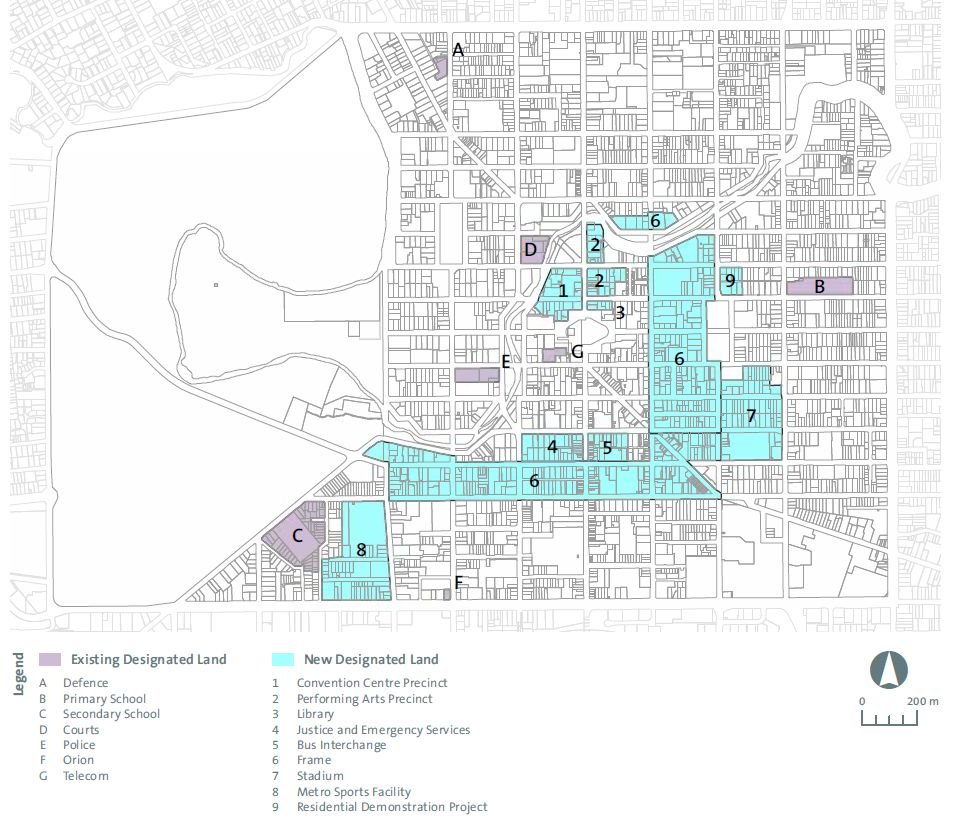
English: Amendments to Christchurch City Council’s District Plan. Map 5. Central City: Existing and new designations. |
| Date | |
| Source | https://ccdu.govt.nz/sites/default/files/documents/christchurch-central-recovery-plan-appendix-1-july-2013.pdf |
| Author | Canterbury Earthquake Recovery Authority |
| Other versions |
.jpg)
.jpg)
.jpg)
Licensing
edit
This file is licensed under the Creative Commons Attribution 3.0 Unported license.
- You are free:
- to share – to copy, distribute and transmit the work
- to remix – to adapt the work
- Under the following conditions:
- attribution – You must give appropriate credit, provide a link to the license, and indicate if changes were made. You may do so in any reasonable manner, but not in any way that suggests the licensor endorses you or your use.
| Annotations | This image is annotated: View the annotations at Commons |
File history
Click on a date/time to view the file as it appeared at that time.
| Date/Time | Thumbnail | Dimensions | User | Comment | |
|---|---|---|---|---|---|
| current | 17:56, 2 December 2015 | | 957 × 821 (157 KB) | Schwede66 (talk | contribs) | User created page with UploadWizard |
You cannot overwrite this file.
File usage on Commons
The following 8 pages use this file:
- File:Chch recovery planning map (Metro Sports Facility).jpg
- File:Chch recovery planning map (cropped).jpg
- File:Chch recovery planning map (northern crop).jpg
- File:Chch recovery planning map (southern designations).jpg
- File:Convention Centre Precinct land designation.jpg
- File:Crowne Plaza Christchurch map.jpg
- File:Planning maps.jpg
- Category:Recovery Plan
.jpg)