File:Chemin de halage bouziès.jpg

Size of this preview: 800 × 536 pixels. Other resolutions: 320 × 214 pixels | 640 × 428 pixels | 1,024 × 685 pixels | 1,280 × 857 pixels | 2,560 × 1,714 pixels | 3,872 × 2,592 pixels.
Original file (3,872 × 2,592 pixels, file size: 1.94 MB, MIME type: image/jpeg)
Captions
Captions
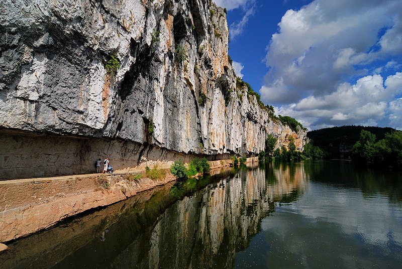
A towpath cut between 1843 and 1847 into the rock beside the Lot river in Bouziès, south-west France
Summary edit
| Description |
Deutsch: Ein in den Rand einer Klippe gehauener Leinpfad, in der Gemeinde von Bouziès im Département Lot
Français : Chemin de halage taillé dans la falaise le long du Lot, sur la commune de Bouziès dans le Lot
|
| Source | Own work |
| Author | Sylvain Crouzillat |
| Camera location | | View this and other nearby images on: OpenStreetMap |
|---|
Licensing edit
| This Photo was taken by croucrou / Sylvain Crouzillat
Cette Photo a été prise par croucrou / Sylvain Crouzillat More pictures in my personal gallery Plus de photos dans ma galerie personnelle Plus d'info sur moi sur mon site web | www.sylvain-crouzillat.com |
I, the copyright holder of this work, hereby publish it under the following licenses:

|
Permission is granted to copy, distribute and/or modify this document under the terms of the GNU Free Documentation License, Version 1.2 or any later version published by the Free Software Foundation; with no Invariant Sections, no Front-Cover Texts, and no Back-Cover Texts. A copy of the license is included in the section entitled GNU Free Documentation License. |
This file is licensed under the Creative Commons Attribution-Share Alike 3.0 Unported, 2.5 Generic, 2.0 Generic and 1.0 Generic license.
- You are free:
- to share – to copy, distribute and transmit the work
- to remix – to adapt the work
- Under the following conditions:
- attribution – You must give appropriate credit, provide a link to the license, and indicate if changes were made. You may do so in any reasonable manner, but not in any way that suggests the licensor endorses you or your use.
- share alike – If you remix, transform, or build upon the material, you must distribute your contributions under the same or compatible license as the original.
You may select the license of your choice.

|
This image has been assessed under the valued image criteria and is considered the most valued image on Commons within the scope: Towpath of Bouziès. You can see its nomination here. |
File history
Click on a date/time to view the file as it appeared at that time.
| Date/Time | Thumbnail | Dimensions | User | Comment | |
|---|---|---|---|---|---|
| current | 17:37, 24 September 2007 | | 3,872 × 2,592 (1.94 MB) | Croucrou (talk | contribs) | {{Information |Description= Chemin de halage taillé dans la falaise, sur la commune de Bouziès dans le Lot |Source=travail personnel |Date= |Author= Croucrou }} |
You cannot overwrite this file.
File usage on Commons
The following 6 pages use this file:
File usage on other wikis
The following other wikis use this file:
- Usage on ar.wikipedia.org
- Usage on ceb.wikipedia.org
- Usage on cs.wikipedia.org
- Usage on de.wikipedia.org
- Usage on en.wikipedia.org
- Usage on eo.wikipedia.org
- Usage on fr.wikipedia.org
- Usage on ja.wikipedia.org
- Usage on ko.wikipedia.org
- Usage on ms.wikipedia.org
- Usage on nl.wikipedia.org
- Usage on nn.wikipedia.org
- Usage on oc.wikipedia.org
- Usage on pl.wikipedia.org
- Usage on ro.wikipedia.org