File:Chennai Wikivoyage map.png
Size of this preview: 446 × 600 pixels. Other resolutions: 178 × 240 pixels | 357 × 480 pixels | 571 × 768 pixels | 761 × 1,024 pixels | 1,523 × 2,048 pixels | 3,403 × 4,577 pixels.
Original file (3,403 × 4,577 pixels, file size: 1.91 MB, MIME type: image/png)
Captions
Captions
Add a one-line explanation of what this file represents
Summary
edit
| Description |
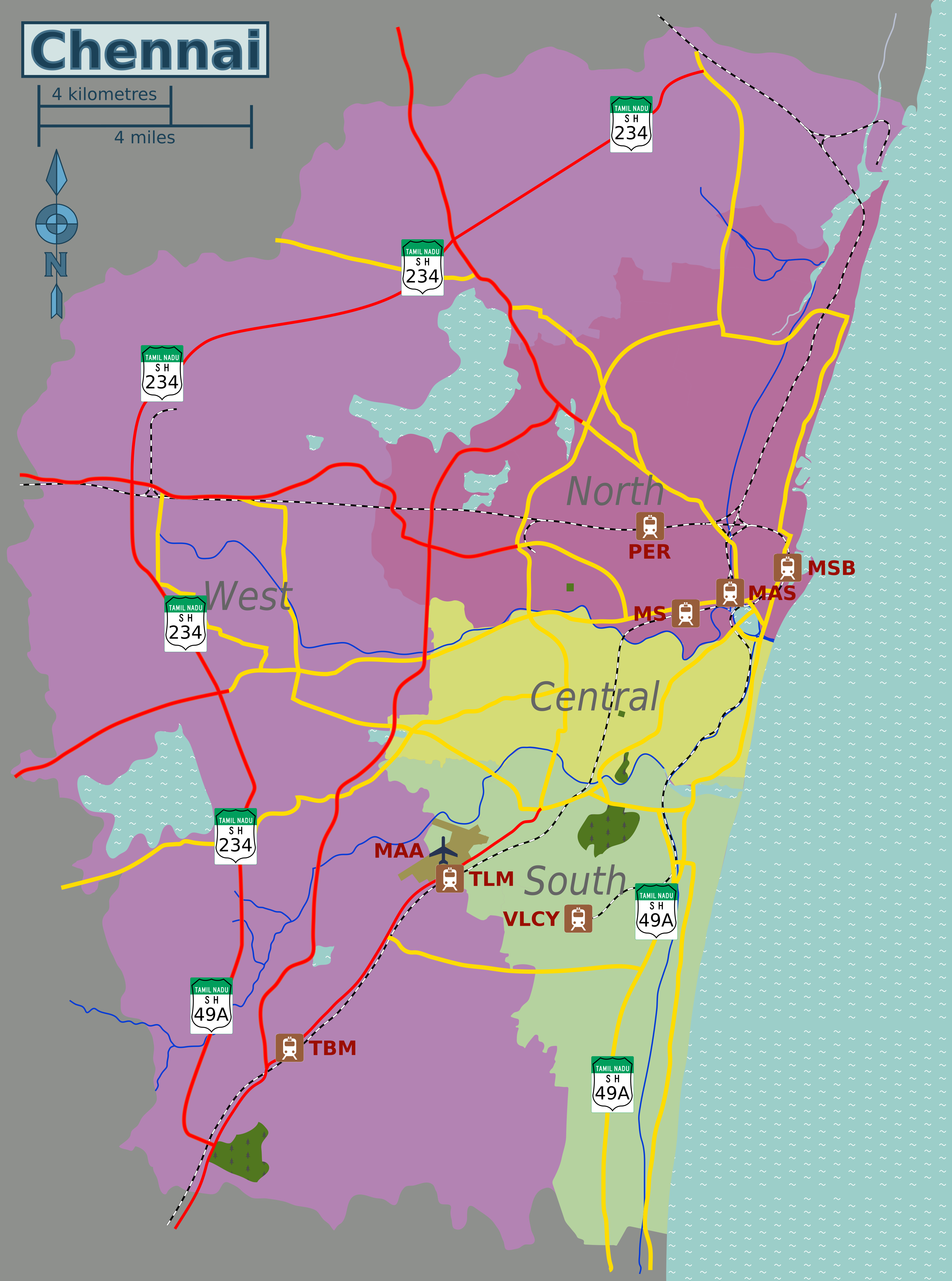
English: Map of Chennai for use in Wikivoyage. |
| Date | |
| Source |
This file was derived from: Chennai area locator map.svg |
| Author | Planemad (original map), Sbb1413 (derived map) |
Licensing
edit

|
Permission is granted to copy, distribute and/or modify this document under the terms of the GNU Free Documentation License, Version 1.2 or any later version published by the Free Software Foundation; with no Invariant Sections, no Front-Cover Texts, and no Back-Cover Texts. A copy of the license is included in the section entitled GNU Free Documentation License. |
If this file is eligible for relicensing, it may also be used under the Creative Commons Attribution-ShareAlike 3.0 license. The relicensing status of this image has not yet been reviewed. You can help.
|
This file is licensed under the Creative Commons Attribution-Share Alike 2.5 Generic, 2.0 Generic and 1.0 Generic license.
- You are free:
- to share – to copy, distribute and transmit the work
- to remix – to adapt the work
- Under the following conditions:
- attribution – You must give appropriate credit, provide a link to the license, and indicate if changes were made. You may do so in any reasonable manner, but not in any way that suggests the licensor endorses you or your use.
- share alike – If you remix, transform, or build upon the material, you must distribute your contributions under the same or compatible license as the original.
File history
Click on a date/time to view the file as it appeared at that time.
| Date/Time | Thumbnail | Dimensions | User | Comment | |
|---|---|---|---|---|---|
| current | 08:06, 5 June 2023 | | 3,403 × 4,577 (1.91 MB) | Sbb1413 (talk | contribs) | Outer Ring Rd |
| 07:51, 4 June 2023 |  | 3,403 × 4,577 (1.8 MB) | Sbb1413 (talk | contribs) | fix | |
| 07:02, 4 June 2023 |  | 3,403 × 4,577 (1.82 MB) | Sbb1413 (talk | contribs) | Uploaded a work by {{U|Planemad}} (original map), {{U|Sbb1413}} (derived map) from {{derived from|Chennai area locator map.svg}} with UploadWizard |
You cannot overwrite this file.
File usage on Commons
The following 2 pages use this file:
File usage on other wikis
The following other wikis use this file: