File:Cheshire-Later-Hundreds.svg

Size of this PNG preview of this SVG file: 600 × 600 pixels. Other resolutions: 240 × 240 pixels | 480 × 480 pixels | 768 × 768 pixels | 1,024 × 1,024 pixels | 2,048 × 2,048 pixels | 1,166 × 1,166 pixels.
Original file (SVG file, nominally 1,166 × 1,166 pixels, file size: 115 KB)
Captions
Captions
Add a one-line explanation of what this file represents
Summary edit
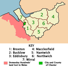
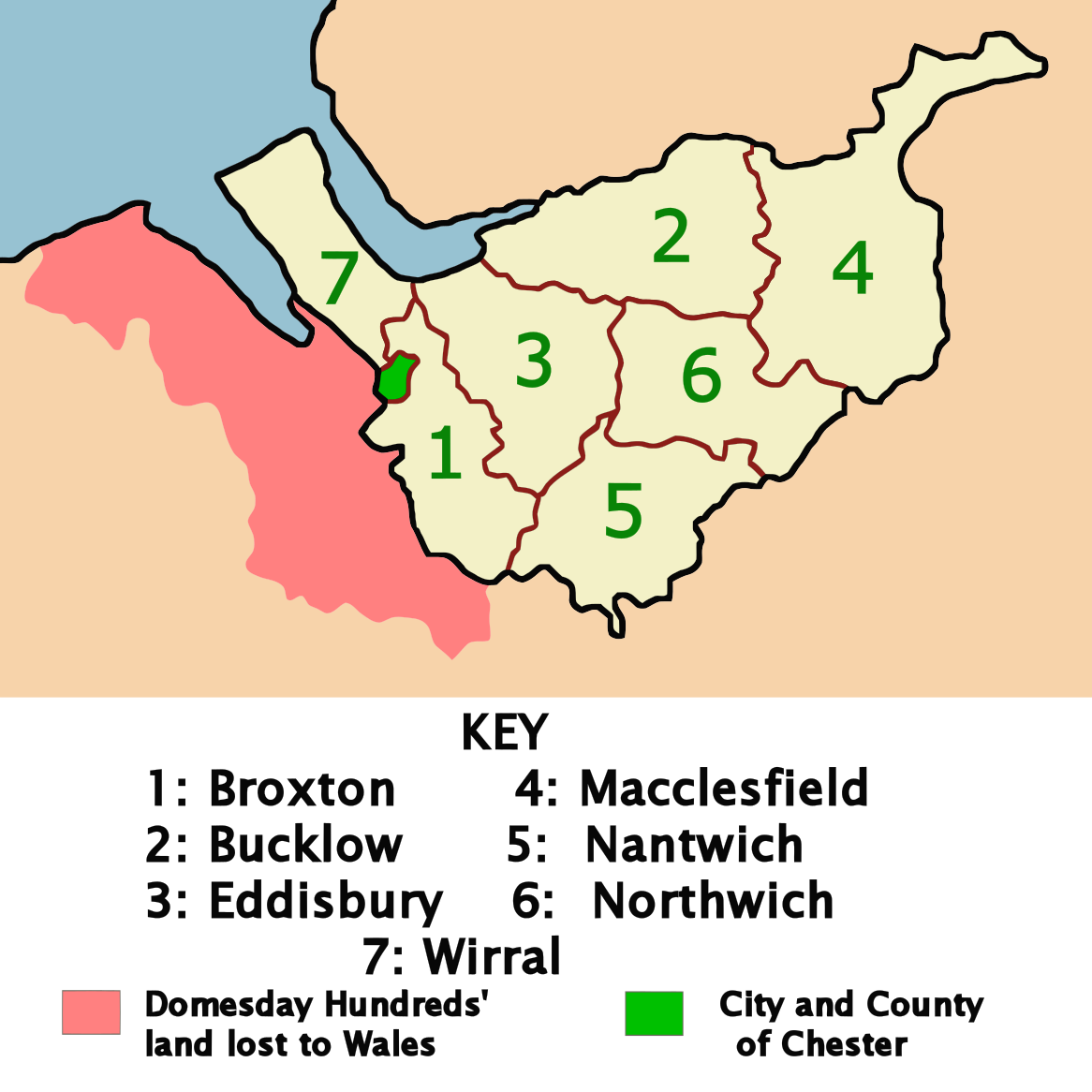
| Description | Map of the Later Hundreds of Cheshire, UK around 1850. The area of land that was in Cheshire at the time of the Domesday Book, but which was subsequently lost to Wales is shown in red. The city of Chester, which was designated a county of itself and not part of any of the hundreds is shown in green. |
| Source | Own work |
| Author | David D. Stretch Ddstretch |
Licensing edit
| I, the copyright holder of this work, release this work into the public domain. This applies worldwide. In some countries this may not be legally possible; if so: I grant anyone the right to use this work for any purpose, without any conditions, unless such conditions are required by law. |
File history
Click on a date/time to view the file as it appeared at that time.
| Date/Time | Thumbnail | Dimensions | User | Comment | |
|---|---|---|---|---|---|
| current | 00:16, 23 February 2008 | | 1,166 × 1,166 (115 KB) | Ddstretch (talk | contribs) | {{Information |Description=Map of the Later Hundreds of Cheshire, UK around 1850. The area of land that was in Cheshire at the time of the Domesday Book, but which was subsequently lost to Wales is shown in red. The city of Chester, which was designated a |
You cannot overwrite this file.
File usage on Commons
There are no pages that use this file.
File usage on other wikis
The following other wikis use this file:
- Usage on en.wikipedia.org