File:Chiapas Distrito 10.svg

Size of this PNG preview of this SVG file: 648 × 600 pixels. Other resolutions: 259 × 240 pixels | 519 × 480 pixels | 830 × 768 pixels | 1,107 × 1,024 pixels | 2,213 × 2,048 pixels | 1,031 × 954 pixels.
Original file (SVG file, nominally 1,031 × 954 pixels, file size: 284 KB)
Captions
Captions
Add a one-line explanation of what this file represents
Summary
edit
| Description |
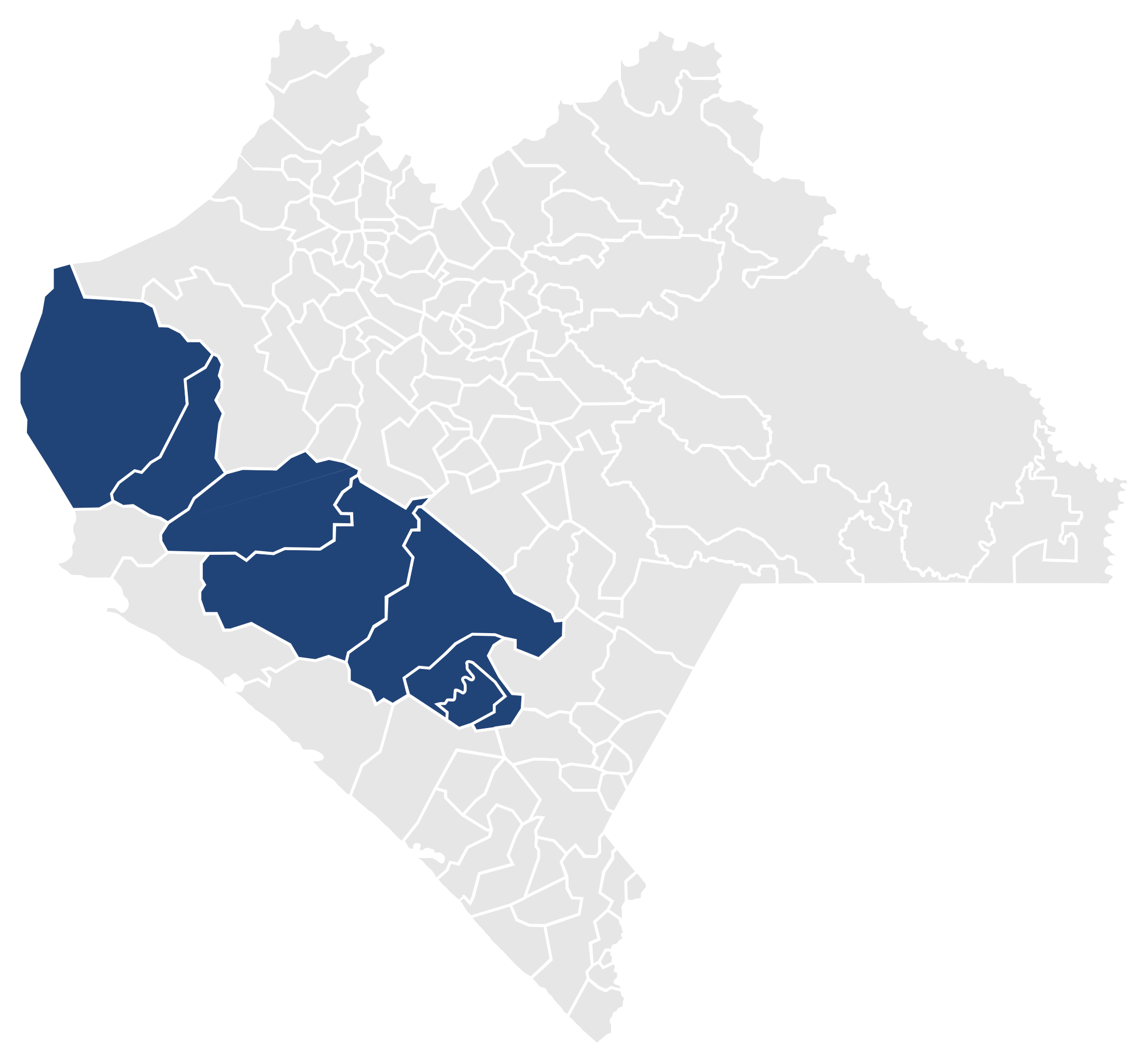
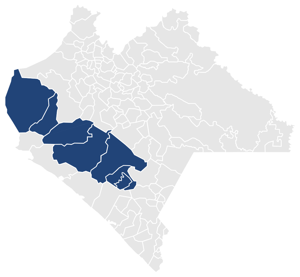
Español: Mapa del X Distrito Electoral Federal del estado de Chiapas, México.
English: Map of the Tenth Federal Electoral District of the State of Chiapas, México. |
| Date | |
| Source | Own work |
| Author | Battroid |
| Permission (Reusing this file) |
I, the copyright holder of this work, hereby publish it under the following license: This file is licensed under the Creative Commons Attribution-Share Alike 2.5 Generic license.
|
File history
Click on a date/time to view the file as it appeared at that time.
| Date/Time | Thumbnail | Dimensions | User | Comment | |
|---|---|---|---|---|---|
| current | 07:23, 12 January 2008 | | 1,031 × 954 (284 KB) | Battroid (talk | contribs) | == Summary == {{Information| |Description=*{{es icon}} Mapa del X Distrito Electoral Federal del estado de Chiapas, México. *{{en icon}} Map of the Tenth Federal Electoral District of the State of Chiapas, México. |Source=own work |Date=January 12, 2008 |
You cannot overwrite this file.
File usage on Commons
There are no pages that use this file.
File usage on other wikis
The following other wikis use this file:
- Usage on en.wikipedia.org
- Usage on es.wikipedia.org