File:Chief Kashakes' House, Mile 2.5 South Tongass Highway, Saxman, Ketchikan Gateway Borough, AK HABS AK,010-SAXM,2- (sheet 6 of 9).tif

Size of this JPG preview of this TIF file: 800 × 532 pixels. Other resolutions: 320 × 213 pixels | 640 × 426 pixels | 1,024 × 681 pixels | 1,280 × 851 pixels | 2,560 × 1,702 pixels | 14,484 × 9,632 pixels.
Original file (14,484 × 9,632 pixels, file size: 577 KB, MIME type: image/tiff)
Captions
Captions
Add a one-line explanation of what this file represents
Summary edit
| Warning | The original file is very high-resolution. It might not load properly or could cause your browser to freeze when opened at full size. |
|---|
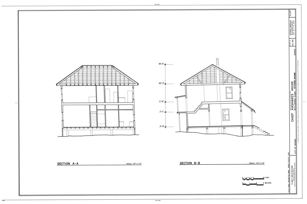
| HABS AK,010-SAXM,2- (sheet 6 of 9) - Chief Kashakes' House, Mile 2.5 South Tongass Highway, Saxman, Ketchikan Gateway Borough, AK | ||||
|---|---|---|---|---|
| Title |
HABS AK,010-SAXM,2- (sheet 6 of 9) - Chief Kashakes' House, Mile 2.5 South Tongass Highway, Saxman, Ketchikan Gateway Borough, AK |
|||
| Depicted place | Alaska; Ketchikan Gateway Borough; Saxman | |||
| Date | Documentation compiled after 1933 | |||
| Medium | 24 x 36 in. (D size) | |||
| Current location |
Library of Congress Prints and Photographs Division Washington, D.C. 20540 USA http://hdl.loc.gov/loc.pnp/pp.print |
|||
| Accession number |
HABS AK,010-SAXM,2- (sheet 6 of 9) |
|||
| Credit line |
|
|||
| Notes |
|
|||
| References |
|
|||
| Source | https://www.loc.gov/pictures/item/ak0436.sheet.00006a | |||
| Permission (Reusing this file) |
|
|||
| Other versions |
.png) .png) .png) .png) .png) .png) .png) .png) .png) |
|||

| Object location | | View this and other nearby images on: OpenStreetMap |
|---|
File history
Click on a date/time to view the file as it appeared at that time.
| Date/Time | Thumbnail | Dimensions | User | Comment | |
|---|---|---|---|---|---|
| current | 22:05, 25 June 2014 |  | 14,484 × 9,632 (577 KB) | Fæ (talk | contribs) | GWToolset: Creating mediafile for Fæ. HABS batch upload start 25 June 2014 |
You cannot overwrite this file.
File usage on Commons
The following 2 pages use this file:
- File:Chief Kashakes' House, Mile 2.5 South Tongass Highway, Saxman, Ketchikan Gateway Borough, AK HABS AK,010-SAXM,2- (sheet 6 of 9).tif
- File:HABS AK,010-SAXM,2- (sheet 6 of 9) - Chief Kashakes' House, Mile 2.5 South Tongass Highway, Saxman, Ketchikan Gateway Borough, AK HABS AK,010-SAXM,2- (sheet 6 of 9).tif (file redirect)