File:China-Qinghai.png
No higher resolution available.
China-Qinghai.png (268 × 218 pixels, file size: 15 KB, MIME type: image/png)
Captions
Captions
Add a one-line explanation of what this file represents
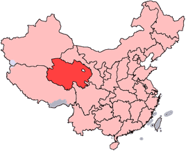
en: Location of Qinghai Province in the People's Republic of China. See Locator maps of province-level divisions of the People's Republic of China for more information.
zh: 青海省在中華人民共和國的位置。另見Locator maps of province-level divisions of the People's Republic of China。

|
Permission is granted to copy, distribute and/or modify this document under the terms of the GNU Free Documentation License, Version 1.2 or any later version published by the Free Software Foundation; with no Invariant Sections, no Front-Cover Texts, and no Back-Cover Texts. A copy of the license is included in the section entitled GNU Free Documentation License. |
| This file is licensed under the Creative Commons Attribution-Share Alike 3.0 Unported license. | ||
| ||
| This licensing tag was added to this file as part of the GFDL licensing update. |
File history
Click on a date/time to view the file as it appeared at that time.
| Date/Time | Thumbnail | Dimensions | User | Comment | |
|---|---|---|---|---|---|
| current | 14:56, 15 July 2005 | | 268 × 218 (15 KB) | Schaengel89~commonswiki (talk | contribs) | transparent background |
| 22:39, 4 June 2005 |  | 268 × 218 (9 KB) | Ran (talk | contribs) | '''en''': Location of Qinghai Province in the People's Republic of China. See Category:Locator maps of province-level divisions of the People's Republic of China for more information. '''zh''': 青海省在中華人民共和國的位置。另見[[:C |
You cannot overwrite this file.
File usage on Commons
The following page uses this file:
File usage on other wikis
The following other wikis use this file:
- Usage on cy.wikipedia.org
- Usage on da.wikipedia.org
- Usage on de.wikipedia.org
- Usage on en.wikipedia.org
- Wikipedia:WikiProject Chinese provinces/Locator maps
- Ledu, Haidong
- Henan Mongol Autonomous County
- Golmud Airport
- Template:Qinghai-geo-stub
- Bayan Har Mountains
- Wenquan, Golmud
- Mangra
- Zêkog County
- Tongren, Qinghai
- Jainca County
- 2008 Tibetan unrest
- Huzhu Tu Autonomous County
- Ping'an, Haidong
- Chengzhong, Xining
- Xireg
- Chengdong, Xining
- Chengbei, Xining
- Datong Hui and Tu Autonomous County
- Huangyuan County
- Huangzhong, Xining
- Hualong Hui Autonomous County
- Haiyan County, Qinghai
- Gangca County
- Menyuan Hui Autonomous County
- Gonghe County
- Tongde County
- Guide County
- Guinan County
- Maqên County
- Banma County
- Gadê County
- Darlag County
- Jigzhi County
- Madoi County
View more global usage of this file.