File:China Inner Mongolia relief location map.png

Size of this preview: 798 × 600 pixels. Other resolutions: 320 × 240 pixels | 639 × 480 pixels | 1,022 × 768 pixels | 1,280 × 962 pixels | 2,000 × 1,503 pixels.
Original file (2,000 × 1,503 pixels, file size: 5.72 MB, MIME type: image/png)
Captions
Captions
Add a one-line explanation of what this file represents
| Description |
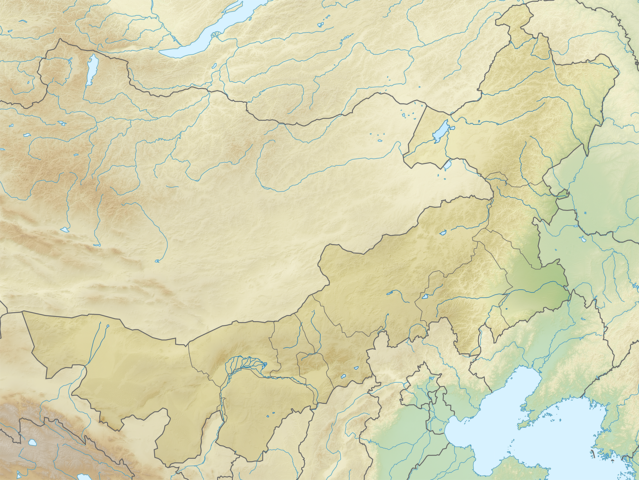
English: Location map of Inner Mongolia, People's Republic of China
Equirectangular projection, N/S stretching 141 %. True scale parallel: 45°00' N. Geographic limits of the map:
|
| Date | (UTC) |
| Source | |
| Author |
|
| This is a retouched picture, which means that it has been digitally altered from its original version. The original can be viewed here: China Inner Mongolia location map.svg:
|
I, the copyright holder of this work, hereby publish it under the following licenses:
This file is licensed under the Creative Commons Attribution-Share Alike 3.0 Unported license.
- You are free:
- to share – to copy, distribute and transmit the work
- to remix – to adapt the work
- Under the following conditions:
- attribution – You must give appropriate credit, provide a link to the license, and indicate if changes were made. You may do so in any reasonable manner, but not in any way that suggests the licensor endorses you or your use.
- share alike – If you remix, transform, or build upon the material, you must distribute your contributions under the same or compatible license as the original.

|
Permission is granted to copy, distribute and/or modify this document under the terms of the GNU Free Documentation License, Version 1.2 or any later version published by the Free Software Foundation; with no Invariant Sections, no Front-Cover Texts, and no Back-Cover Texts. A copy of the license is included in the section entitled GNU Free Documentation License. |
You may select the license of your choice.
Original upload log edit
This image is a derivative work of the following images:
- File:China_Inner_Mongolia_location_map.svg licensed with Cc-by-sa-3.0, GFDL
- 2011-02-20T21:56:03Z Das steinerne Herz 577x433 (374280 Bytes) completly new version
- 2011-02-13T19:55:46Z Das steinerne Herz 663x500 (2319654 Bytes) trying to correct
- 2011-02-10T14:14:56Z Das steinerne Herz 664x508 (2319564 Bytes) cropping
- 2011-02-10T08:02:33Z Das steinerne Herz 748x605 (2264902 Bytes) correction
- 2011-02-09T18:54:26Z Das steinerne Herz 748x605 (2273721 Bytes) {{Information |Description ={{en|1=Location map of [[:en:Inner Mongolia|Inner Mongolia]], [[:en:People's Republic of China|People's Republic of China]] Equirectangular projection, N/S stretching 141 %. Geographic limits of
Uploaded with derivativeFX
File history
Click on a date/time to view the file as it appeared at that time.
| Date/Time | Thumbnail | Dimensions | User | Comment | |
|---|---|---|---|---|---|
| current | 09:00, 24 February 2011 | | 2,000 × 1,503 (5.72 MB) | Das steinerne Herz (talk | contribs) | {{Information |Description={{en|1=Location map of Inner Mongolia, People's Republic of China Equirectangular projection, N/S stretching 141 %. True scale parallel: 45°00' N. Geographic limits of t |
You cannot overwrite this file.
File usage on Commons
There are no pages that use this file.
File usage on other wikis
The following other wikis use this file:
- Usage on ar.wikipedia.org
- Usage on ba.wikipedia.org
- Usage on bg.wikipedia.org
- Usage on bn.wikipedia.org
- Usage on ceb.wikipedia.org
- Usage on cv.wikipedia.org
- Usage on de.wikipedia.org
- Usage on en.wikipedia.org
View more global usage of this file.