File:Chrudimka, CZ150420-001.jpg
Size of this preview: 800 × 509 pixels. Other resolutions: 320 × 204 pixels | 640 × 407 pixels | 1,024 × 651 pixels | 1,280 × 814 pixels | 2,560 × 1,628 pixels | 4,548 × 2,893 pixels.
Original file (4,548 × 2,893 pixels, file size: 8.27 MB, MIME type: image/jpeg)
Captions
Captions
Add a one-line explanation of what this file represents
Summary edit
| Description |
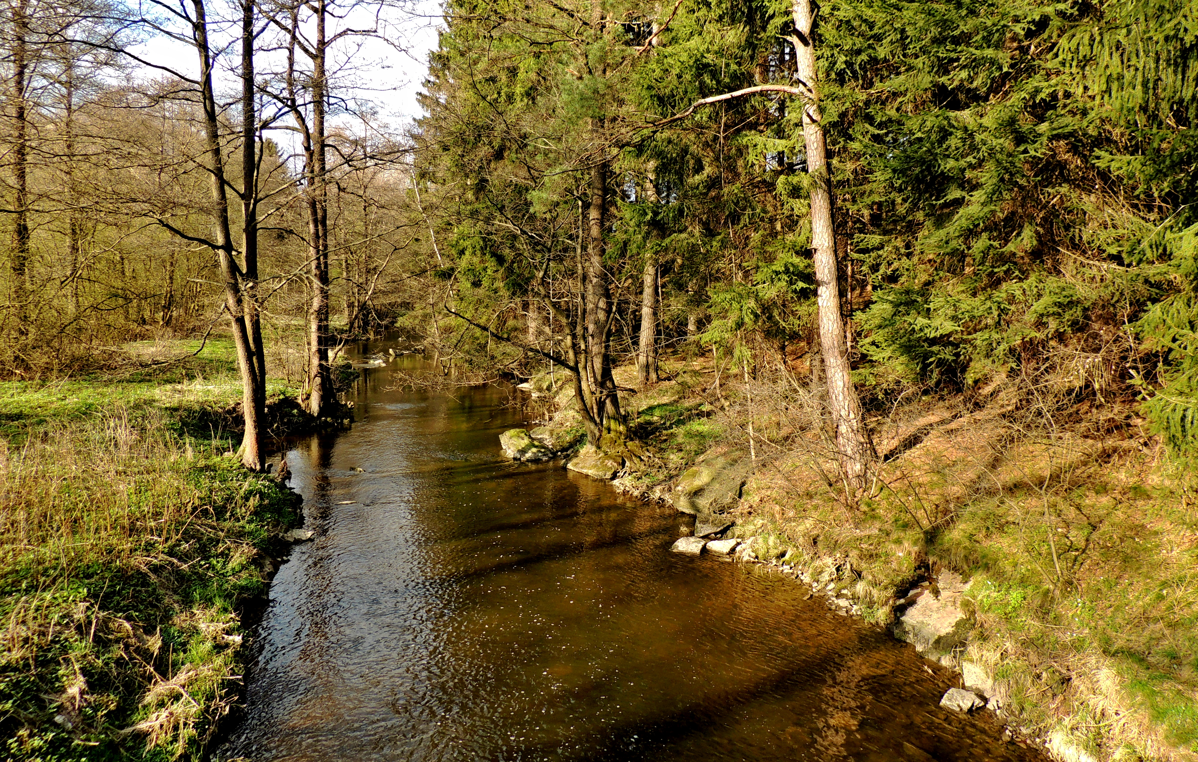
English: The upper reaches of Chrudimka river at an altitude of 589 m below Hamerska dam. In a short section (see photo), the river forms the border between the cadastral area of Studnice and Hamry (right bank). In the kilometer of the river 93.2 "Hamerská" Dam (name according to village Hamry), her built in 1907-1912 with of earth dike like at the pond. Chrudimka flows into the reservoir in the form of a large brook, from the dam flows like a small river. In the locality since 1913 the river flow measurement is realized, the measuring station with name "Hamry" is operating of Czech Hydrometeorological Institute. Photo location: Czechia, Pardubice Region, cadastral territory of municipalities Hamry and Studnice, "Kameničská" Highlands, the river Chrudimka.
Čeština: Horní tok řeky Chrudimky v nadmořské výšce 589 m pod Hamerskou přehradou. V krátkém úseku (viz foto) tvoří řeka hranici mezi katastrálním územím obce Studnice a Hamry (pravý břeh). V říčním km 93,2 Hamerská přehrada (název podle obce Hamry) vybudovaná v letech 1907–1912 se sypanou zemní hrází, podobně jako u rybníku. Chrudimka proudí do vodní nádrže ve formě velkého potoka, od přehrady proudí jako malá řeka. V lokalitě od roku 1913 prováděno měření průtoku řeky, měřící stanici Hamry provozuje Český hydrometeorologický ústav. Foto lokace: Česko, Pardubický kraj, katastrální území obcí Hamry a Studnice, Kameničská vrchovina, řeka Chrudimka pod Hamerskou přehradou (15°). |
| Date | |
| Source | Own work |
| Author | Josef Kreuz (PEPan) |
| Permission (Reusing this file) |
I, the copyright holder of this work, hereby publish it under the following license: This file is licensed under the Creative Commons Attribution-Share Alike 4.0 International license.
|
| Camera location | | View this and other nearby images on: OpenStreetMap |
|---|
Externí odkazy: edit
- Základní mapa Česka – řeka Chrudimka pod Hamerskou přehradou viz
- Hlásný profil průtoku na řece Chrudimce – stanice Hamry viz archive copy at the Wayback Machine
- Český hydrometeorologický ústav, počasí a průtok na vodních tocích – webové stránky viz archive copy at the Wayback Machine
- Turistická mapa (letecký pohled) – řeka Chrudimka a vodní nádrž Hamry viz
File history
Click on a date/time to view the file as it appeared at that time.
| Date/Time | Thumbnail | Dimensions | User | Comment | |
|---|---|---|---|---|---|
| current | 10:48, 28 January 2018 | | 4,548 × 2,893 (8.27 MB) | PEPan (talk | contribs) | User created page with UploadWizard |
You cannot overwrite this file.
File usage on Commons
There are no pages that use this file.
File usage on other wikis
The following other wikis use this file:
- Usage on cs.wikipedia.org