File:Chyulu Hills.jpg
No higher resolution available.
Chyulu_Hills.jpg (535 × 480 pixels, file size: 53 KB, MIME type: image/jpeg)
Captions
Captions
Add a one-line explanation of what this file represents
Summary edit
| Description |
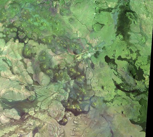
English: The dark lava flows at the right side of this Landsat image are from vents at the western end of the Chyulu Hills volcanic field, Kenya. This 100-km-long, NW-SE-trending volcanic field is located 150 km east of the Kenya Rift. Two of the several hundred small cones and flows, Shaitani and Chaimu, erupted during the mid-19th century. Many of the cinder cones are aligned along dominantly NW-trending older faults and younger NNE-trending fissures. |
| Date | |
| Source | http://www.volcano.si.edu/world/volcano.cfm?vnum=0202-13=&volpage=photos&photo=111054 |
| Author | NASA Landsat image (courtesy of Hawaii Synergy Project, Univ. of Hawaii Institute of Geophysics & Planetology) |
Licensing edit
| This file is in the public domain in the United States because it was solely created by NASA. NASA copyright policy states that "NASA material is not protected by copyright unless noted". (See Template:PD-USGov, NASA copyright policy page or JPL Image Use Policy.) | ||
 |
Warnings:
|
File history
Click on a date/time to view the file as it appeared at that time.
| Date/Time | Thumbnail | Dimensions | User | Comment | |
|---|---|---|---|---|---|
| current | 19:29, 25 October 2011 | | 535 × 480 (53 KB) | Michael Metzger (talk | contribs) |
You cannot overwrite this file.
File usage on Commons
There are no pages that use this file.
File usage on other wikis
The following other wikis use this file:
- Usage on de.wikipedia.org