File:Ciamuria in Albania e Grecia.png
Size of this preview: 494 × 599 pixels. Other resolutions: 198 × 240 pixels | 396 × 480 pixels | 633 × 768 pixels | 845 × 1,024 pixels | 2,500 × 3,031 pixels.
Original file (2,500 × 3,031 pixels, file size: 818 KB, MIME type: image/png)
Captions
Captions
Add a one-line explanation of what this file represents
Summary
edit
| Description |
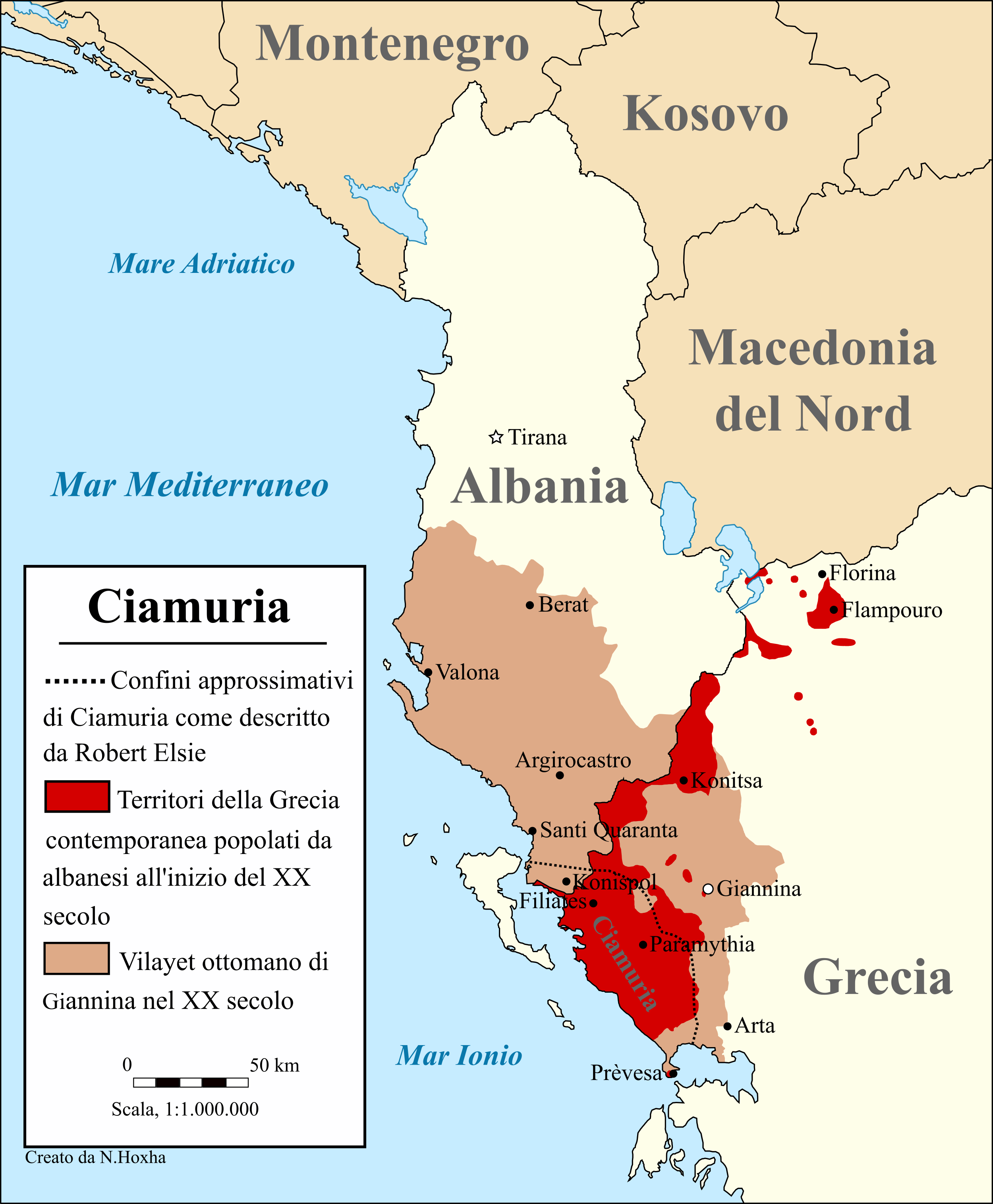
Italiano: La mappa illustra i confini della storica regione di Ciamuria come descritto da Robert Elsie. La mappa mostra anche il vilayet ottomano di Giannina e le aree della Grecia contemporanea che furono abitate dagli albanesi all'inizio del XX secolo. |
| Date | |
| Source |
Own work
|
| Author | N.Hoxha |
Licensing
edit
I, the copyright holder of this work, hereby publish it under the following license:
This file is licensed under the Creative Commons Attribution-Share Alike 4.0 International license.
- You are free:
- to share – to copy, distribute and transmit the work
- to remix – to adapt the work
- Under the following conditions:
- attribution – You must give appropriate credit, provide a link to the license, and indicate if changes were made. You may do so in any reasonable manner, but not in any way that suggests the licensor endorses you or your use.
- share alike – If you remix, transform, or build upon the material, you must distribute your contributions under the same or compatible license as the original.
File history
Click on a date/time to view the file as it appeared at that time.
| Date/Time | Thumbnail | Dimensions | User | Comment | |
|---|---|---|---|---|---|
| current | 21:28, 5 July 2020 | | 2,500 × 3,031 (818 KB) | Ahmet Q. (talk | contribs) | Update |
| 12:23, 3 February 2020 |  | 2,500 × 3,031 (815 KB) | Ahmet Q. (talk | contribs) | User created page with UploadWizard |
You cannot overwrite this file.
File usage on Commons
There are no pages that use this file.
File usage on other wikis
The following other wikis use this file:
- Usage on it.wikipedia.org