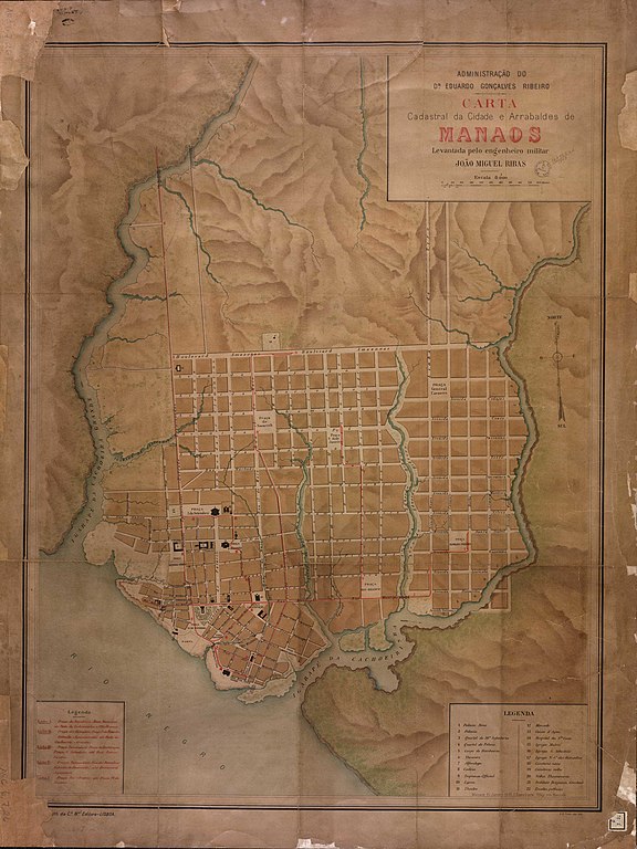
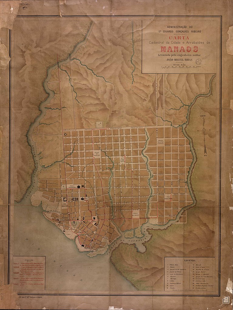
File:Cidade e arrabaldes de Manaus Ribas 1892 Cart164960.jpg

Size of this preview: 449 × 599 pixels. Other resolutions: 180 × 240 pixels | 360 × 480 pixels | 576 × 768 pixels | 768 × 1,024 pixels | 1,535 × 2,048 pixels | 3,161 × 4,216 pixels.
Original file (3,161 × 4,216 pixels, file size: 1.39 MB, MIME type: image/jpeg)
Captions
Captions
Add a one-line explanation of what this file represents
Summary
edit
| Description |
Português: Mapa organizado no período de administração do Dr. Eduardo Gonçalves Ribeiro, governador do Amazonas entre 1892 e 1896. |
| Date | c. 1892–1896 |
| Source | Ribas, João Miguel. “Carta cadastral da cidade e arrabaldes de Manaos”. 1 mapa : col. ; 88 x 66 cm., 1:8000. Lisboa: Lith. Ca. Nal. Editora, 1896 de 1892. ARC.006,07,026 - Cartografia. Biblioteca Nacional (Brasil). http://acervo.bndigital.bn.br/sophia/index.asp?codigo_sophia=83489. |
| Author | João Miguel Ribas |
Licensing
edit
This work is in the public domain in Brazil for one of the following reasons:
|
 |
File history
Click on a date/time to view the file as it appeared at that time.
| Date/Time | Thumbnail | Dimensions | User | Comment | |
|---|---|---|---|---|---|
| current | 23:10, 10 December 2019 | | 3,161 × 4,216 (1.39 MB) | Arqpalazzo (talk | contribs) | User created page with UploadWizard |
You cannot overwrite this file.
File usage on Commons
There are no pages that use this file.