File:Clausen Military cemetery – Gravestone CW Bruno von François.jpg

Size of this preview: 379 × 599 pixels. Other resolutions: 152 × 240 pixels | 304 × 480 pixels | 486 × 768 pixels | 648 × 1,024 pixels | 1,296 × 2,048 pixels | 4,530 × 7,156 pixels.
Original file (4,530 × 7,156 pixels, file size: 23.74 MB, MIME type: image/jpeg)
Captions
Captions
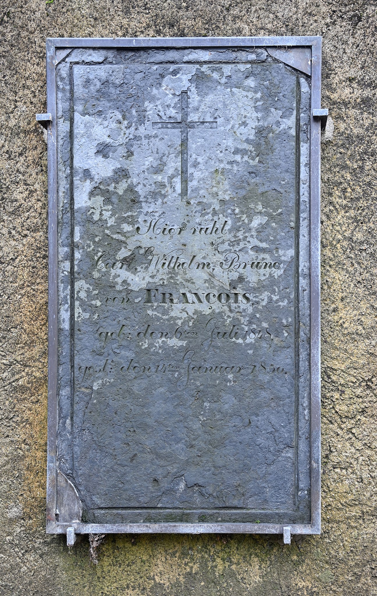
Plaque 1848-1850 in the military cemetery in Clausen, Luxembourg City
Summary
edit
| Description |
English: Gravestone in the German military cemetery in Clausen, Luxembourg City. The plaque reads as follows (translation): Here rests Carl Wilhelm Bruno von François born 6 Juli 1848 died 14 January 1850. Bruno von François,, the father of the boy, was a Prussian officer in the fortress of Luxembourg. The huguenot ancestors of the family had left France for Saxony after the revocation of the Edict of Nantes in 1685 by Louis XIV.
Français : Pierre tombale au cimetière militaire à Clausen, Luxembourg-ville (traduction): Ici repose Carl Wilhelm von François né le 6 juillet 1848 mort le 14 janvier 1850.
Bruno von François, le père du jeune garçon, était officier prussien stationné dans la forteresse de Luxembourg. Les ancêtres huguenots de la famille avaient quitté la France pour le pays de Saxe après la révocation de l'édit de Nantes en 1685 par Louis XIV.
Deutsch: Grabstein im Soldatenfriedhof in Clausen, Luxemburg-Stadt.
Hier ruht Carl Wilhelm Bruno von François geb. den 6. Juli 1848 gestorben den 14. Januar 1850. Bruno von François, der Vater des Jungen, war preußischer Offizier in der Festung Luxemburg. Die hugenotischen Vorfahren der Familie hatten Frankreich nach dem Widerruf des Edikts von Nantes im Jahr 1685 durch Ludwig XIV. verlassen um sich in Sachsen niederzulassen.Lëtzebuergesch: Grafsteen um Zaldotekierfecht a Clausen an der Stad Lëtzebuerg. Op der Plack steet: Hier ruht Carl Wilhelm Bruno von François geb. den 6. Juli 1848 gestorben den 14. Januar 1850.
De Bruno von François, de Papp vum verstuerwene Jong, war preiseschen Offizéier an der Festung Lëtzebuerg. Déi hugenotesch Virfare vun der Famill hate Frankräich no der Revokatioun vum Édit de Nantes duerch de Louis XIV am Joer 1685 verlooss fir sech a Sachsen nidderzeloossen. |
| Date | |
| Source | Own work |
| Author | Cayambe |
| Camera location | | View this and other nearby images on: OpenStreetMap |
|---|
Licensing
edit
I, the copyright holder of this work, hereby publish it under the following license:
This file is licensed under the Creative Commons Attribution-Share Alike 4.0 International license.
- You are free:
- to share – to copy, distribute and transmit the work
- to remix – to adapt the work
- Under the following conditions:
- attribution – You must give appropriate credit, provide a link to the license, and indicate if changes were made. You may do so in any reasonable manner, but not in any way that suggests the licensor endorses you or your use.
- share alike – If you remix, transform, or build upon the material, you must distribute your contributions under the same or compatible license as the original.
This image has been assessed using the Quality image guidelines and is considered a Quality image.
|
File history
Click on a date/time to view the file as it appeared at that time.
| Date/Time | Thumbnail | Dimensions | User | Comment | |
|---|---|---|---|---|---|
| current | 08:33, 5 February 2019 | | 4,530 × 7,156 (23.74 MB) | Cayambe (talk | contribs) | User created page with UploadWizard |
You cannot overwrite this file.
File usage on Commons
The following 6 pages use this file:
- User:Cayambe/Luxembourg/Luxembourg City
- User:Cayambe/Luxembourg/Luxembourg City/Clausen
- User:Zinneke/Nei Biller iwwer Lëtzebuerg/2019 February 1-9
- User talk:Cayambe/Archive10
- Commons:Quality images/Subject/Objects/Statues, Monuments and Plaques/archive 2019-1
- Commons:Quality images candidates/Archives April 18 2019