File:Clearing above Blaen Twrch - geograph.org.uk - 1019873.jpg
No higher resolution available.
Clearing_above_Blaen_Twrch_-_geograph.org.uk_-_1019873.jpg (640 × 427 pixels, file size: 175 KB, MIME type: image/jpeg)
Captions
Captions
Add a one-line explanation of what this file represents
Summary edit
| Description |
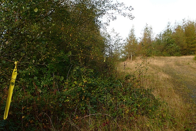
English: Clearing above Blaen Twrch This appears to have been a former mine or quarry distribution area. A bridleway and footpath diverge here each heading down to the valley. The yellow ribbons appeared throughout the forest and appear to have been route markers for a cross-country running or bike event. |
| Date | |
| Source | From geograph.org.uk |
| Author | Graham Horn |
| Attribution (required by the license) | Graham Horn / Clearing above Blaen Twrch / |
| Camera location | | View this and other nearby images on: OpenStreetMap |
|---|
_heading:337.00&language=en)
| Object location | | View this and other nearby images on: OpenStreetMap |
|---|
_heading:337.00&language=en)
Licensing edit

|
This image was taken from the Geograph project collection. See this photograph's page on the Geograph website for the photographer's contact details. The copyright on this image is owned by Graham Horn and is licensed for reuse under the Creative Commons Attribution-ShareAlike 2.0 license.
|
This file is licensed under the Creative Commons Attribution-Share Alike 2.0 Generic license.
Attribution: Graham Horn
- You are free:
- to share – to copy, distribute and transmit the work
- to remix – to adapt the work
- Under the following conditions:
- attribution – You must give appropriate credit, provide a link to the license, and indicate if changes were made. You may do so in any reasonable manner, but not in any way that suggests the licensor endorses you or your use.
- share alike – If you remix, transform, or build upon the material, you must distribute your contributions under the same or compatible license as the original.
File history
Click on a date/time to view the file as it appeared at that time.
| Date/Time | Thumbnail | Dimensions | User | Comment | |
|---|---|---|---|---|---|
| current | 10:23, 23 February 2011 | | 640 × 427 (175 KB) | GeographBot (talk | contribs) | == {{int:filedesc}} == {{Information |description={{en|1=Clearing above Blaen Twrch This appears to have been a former mine or quarry distribution area. A bridleway and footpath diverge here each heading down to the valley. The yellow ribbons appeared t |
You cannot overwrite this file.
File usage on Commons
There are no pages that use this file.