File:Cloud Streets over Lake Superior (MODIS 2020-02-18).jpg

Size of this preview: 799 × 599 pixels. Other resolutions: 320 × 240 pixels | 640 × 480 pixels | 1,024 × 768 pixels | 1,280 × 960 pixels | 2,560 × 1,921 pixels | 3,748 × 2,812 pixels.
Original file (3,748 × 2,812 pixels, file size: 2.02 MB, MIME type: image/jpeg)
Captions
Captions
The Moderate Resolution Imaging Spectroradiometer (MODIS) on board NASA’s Aqua satellite acquired a true-color image of the scene on February 13.
Summary
edit.jpg&action=edit§ion=1)
| Description |
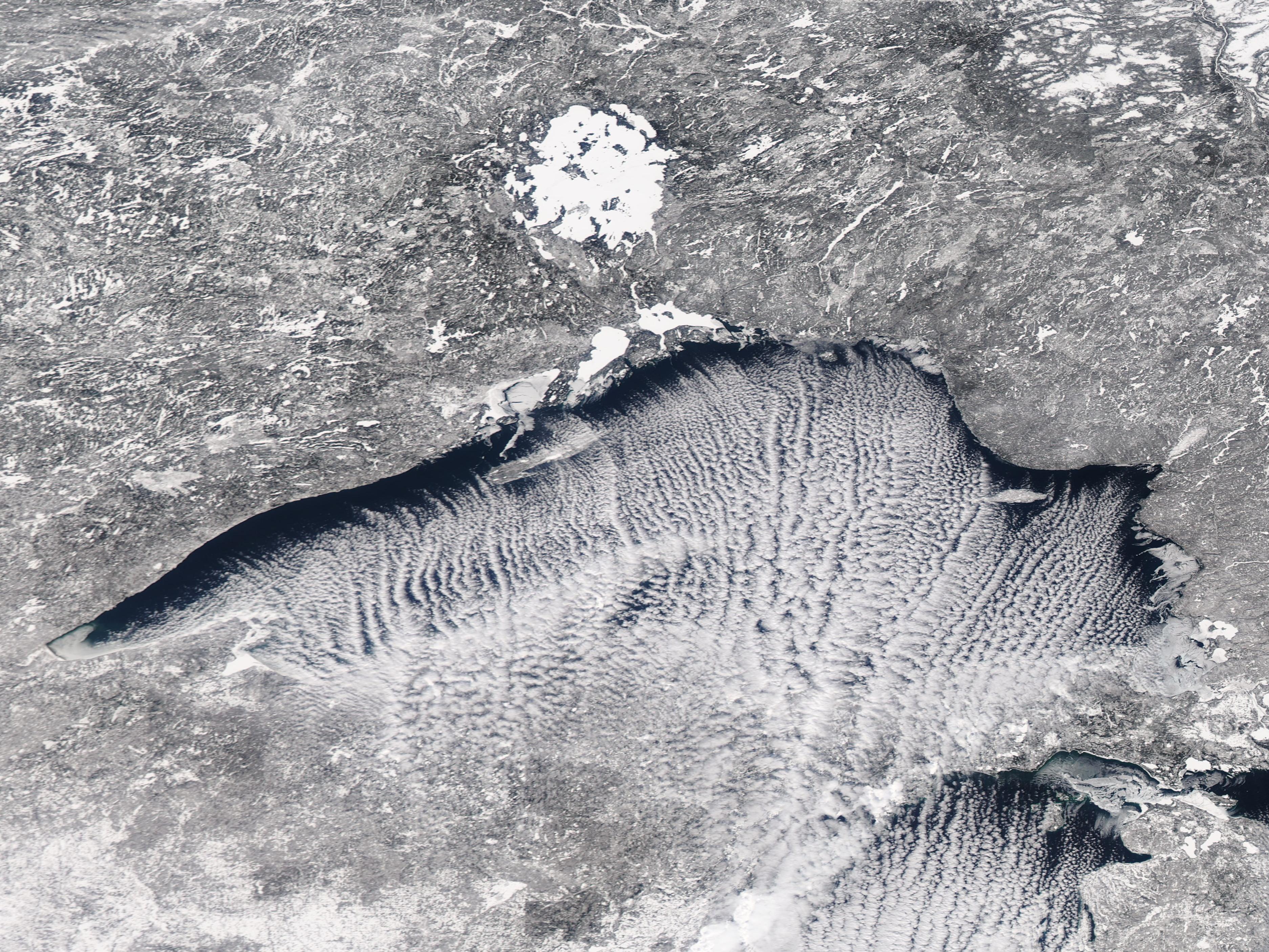
English: Long streaks of cloud were perfectly aligned with and parallel to a frigid north wind blowing over Lake Superior in mid-February 2020. The Moderate Resolution Imaging Spectroradiometer (MODIS) on board NASA’s Aqua satellite acquired a true-color image of the scene on February 13.
The line of cloud, known as “cloud streets", illustrate an Arctic blast as it sweeps over the region. Temperatures at Thunder Bay, Ontario, dropped to a high of 2°F (-16.7°C) on February 13 and a low of -28°F (-33.3°C) on February 14. Thunder Bay sits on the northern shore of Lake Superior. Cloud streets are formed when thermals - or columns of warmer air - rise up through the atmosphere and lift the heat away from the surface of a sea - or a Great Lake. The moist air rises from the warmer body of water until it hits a warmer air layer. This air layer acts like a lid, causing the rising thermals to roll over on themselves, forming parallel cylinders of rotating air. On the upward side of the cylinders (rising air), water vapor condenses and forms clouds. Along the downward side (descending air), skies remain clear. |
||
| Date | Taken on 13 February 2020 | ||
| Source |
Cloud Streets over Lake Superior (direct link)
|
||
| Author | MODIS Land Rapid Response Team, NASA GSFC |
| This media is a product of the Aqua mission Credit and attribution belongs to the mission team, if not already specified in the "author" row |
Licensing
edit.jpg&action=edit§ion=2)
| This file is in the public domain in the United States because it was solely created by NASA. NASA copyright policy states that "NASA material is not protected by copyright unless noted". (See Template:PD-USGov, NASA copyright policy page or JPL Image Use Policy.) | ||
 |
Warnings:
|
File history
Click on a date/time to view the file as it appeared at that time.
| Date/Time | Thumbnail | Dimensions | User | Comment | |
|---|---|---|---|---|---|
| current | 03:18, 17 February 2024 | | 3,748 × 2,812 (2.02 MB) | OptimusPrimeBot (talk | contribs) | #Spacemedia - Upload of http://modis.gsfc.nasa.gov/gallery/images/image02182020_250m.jpg via Commons:Spacemedia |
You cannot overwrite this file.
File usage on Commons
There are no pages that use this file.
.jpg&oldid=881138988)