File:Cocks Viaduct - geograph.org.uk - 1115688.jpg
No higher resolution available.
Cocks_Viaduct_-_geograph.org.uk_-_1115688.jpg (640 × 480 pixels, file size: 104 KB, MIME type: image/jpeg)
Captions
Captions
Add a one-line explanation of what this file represents
Summary
edit
| Description |
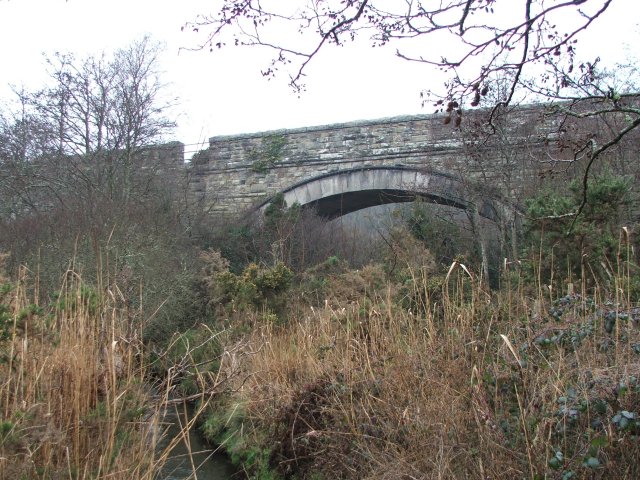
English: Cocks Viaduct Central arch of the viaduct constructed in 1903 to carry the Chacewater - Newquay line, now long closed. |
| Date | |
| Source | From geograph.org.uk |
| Author | Malcolm Kewn |
| Camera location | | View this and other nearby images on: OpenStreetMap |
|---|
_heading:337.00&language=en)
| Object location | | View this and other nearby images on: OpenStreetMap |
|---|
_heading:337.00&language=en)
Licensing
edit

|
This image was taken from the Geograph project collection. See this photograph's page on the Geograph website for the photographer's contact details. The copyright on this image is owned by Malcolm Kewn and is licensed for reuse under the Creative Commons Attribution-ShareAlike 2.0 license.
|
This file is licensed under the Creative Commons Attribution-Share Alike 2.0 Generic license.
Attribution: Malcolm Kewn
- You are free:
- to share – to copy, distribute and transmit the work
- to remix – to adapt the work
- Under the following conditions:
- attribution – You must give appropriate credit, provide a link to the license, and indicate if changes were made. You may do so in any reasonable manner, but not in any way that suggests the licensor endorses you or your use.
- share alike – If you remix, transform, or build upon the material, you must distribute your contributions under the same or compatible license as the original.
File history
Click on a date/time to view the file as it appeared at that time.
| Date/Time | Thumbnail | Dimensions | User | Comment | |
|---|---|---|---|---|---|
| current | 20:47, 24 February 2011 | | 640 × 480 (104 KB) | GeographBot (talk | contribs) | == {{int:filedesc}} == {{Information |description={{en|1=Cocks Viaduct Central arch of the viaduct constructed in 1903 to carry the Chacewater - Newquay line, now long closed.}} |date=2009-01-08 |source=From [http://www.geograph.org.uk/photo/1115688 geogr |
You cannot overwrite this file.
File usage on Commons
There are no pages that use this file.