File:Cologne War 1-es.svg

Size of this PNG preview of this SVG file: 523 × 599 pixels. Other resolutions: 209 × 240 pixels | 419 × 480 pixels | 670 × 768 pixels | 894 × 1,024 pixels | 1,787 × 2,048 pixels | 2,448 × 2,805 pixels.
Original file (SVG file, nominally 2,448 × 2,805 pixels, file size: 232 KB)
Captions
Captions
Add a one-line explanation of what this file represents
Summary
edit
| Description |
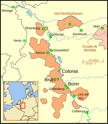
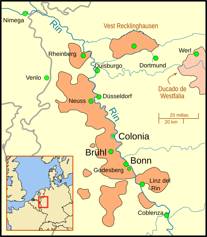
English: A map of the Electorate of Cologne showing major cities of the Electorate (Cologne, Bruhl, Bonn) as well as towns involved in the War and other important cities in the area.
The outline of the Electorate is based on Willem and Joan(nes) Blaeu's 1645 map File:Blaeu 1645 - Coloniensis Archiepiscopatus.jpg. The gray lines show modern day national borders. Except for the Emscher river, the rivers are shown in their modern routes/channels/paths. This map uses a Mercator projection. |
| Date | |
| Source | Cologne War 1.svg |
| Author |
|
Licensing
edit
I, the copyright holder of this work, hereby publish it under the following license:
This file is licensed under the Creative Commons Attribution-Share Alike 4.0 International license.
- You are free:
- to share – to copy, distribute and transmit the work
- to remix – to adapt the work
- Under the following conditions:
- attribution – You must give appropriate credit, provide a link to the license, and indicate if changes were made. You may do so in any reasonable manner, but not in any way that suggests the licensor endorses you or your use.
- share alike – If you remix, transform, or build upon the material, you must distribute your contributions under the same or compatible license as the original.
File history
Click on a date/time to view the file as it appeared at that time.
| Date/Time | Thumbnail | Dimensions | User | Comment | |
|---|---|---|---|---|---|
| current | 08:42, 4 December 2015 | | 2,448 × 2,805 (232 KB) | Rowanwindwhistler (talk | contribs) | User created page with UploadWizard |
You cannot overwrite this file.
File usage on Commons
The following page uses this file:
File usage on other wikis
The following other wikis use this file:
- Usage on es.wikipedia.org