File:Colombia Valle del Cauca loc map.svg

Size of this PNG preview of this SVG file: 497 × 599 pixels. Other resolutions: 199 × 240 pixels | 398 × 480 pixels | 637 × 768 pixels | 849 × 1,024 pixels | 1,698 × 2,048 pixels | 1,763 × 2,126 pixels.
Original file (SVG file, nominally 1,763 × 2,126 pixels, file size: 477 KB)
Captions
Captions
Add a one-line explanation of what this file represents
| Description |
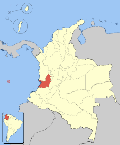
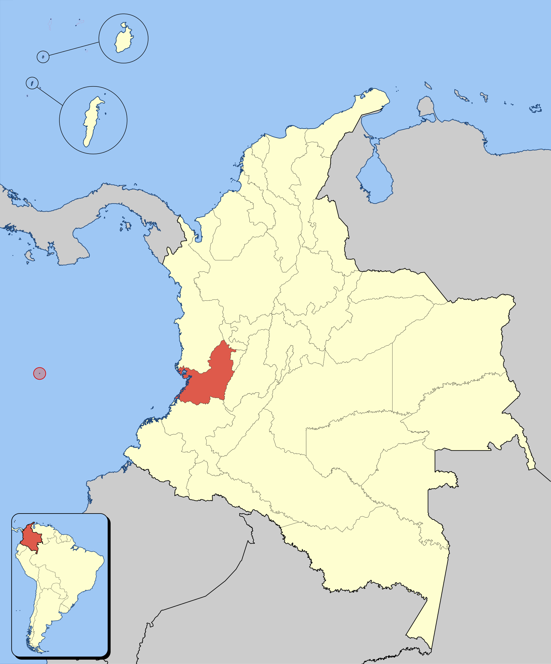
English: SVG locator map of valle del cauca in Colombia. Español: Mapa tipo svg de valle del cauca. |
| Date | |
| Source | Own work |
| Author | Shadowxfox |
| Permission (Reusing this file) |
Own work, copyleft: Multi-license with GFDL and Creative Commons CC-BY-SA-2.5 and older versions (2.0 and 1.0) |
I, the copyright holder of this work, hereby publish it under the following licenses:

|
Permission is granted to copy, distribute and/or modify this document under the terms of the GNU Free Documentation License, Version 1.2 or any later version published by the Free Software Foundation; with no Invariant Sections, no Front-Cover Texts, and no Back-Cover Texts. A copy of the license is included in the section entitled GNU Free Documentation License. |
| This file is licensed under the Creative Commons Attribution-Share Alike 3.0 Unported license. | ||
| ||
| This licensing tag was added to this file as part of the GFDL licensing update. |
This file is licensed under the Creative Commons Attribution-Share Alike 2.5 Generic, 2.0 Generic and 1.0 Generic license.
- You are free:
- to share – to copy, distribute and transmit the work
- to remix – to adapt the work
- Under the following conditions:
- attribution – You must give appropriate credit, provide a link to the license, and indicate if changes were made. You may do so in any reasonable manner, but not in any way that suggests the licensor endorses you or your use.
- share alike – If you remix, transform, or build upon the material, you must distribute your contributions under the same or compatible license as the original.
You may select the license of your choice.
File history
Click on a date/time to view the file as it appeared at that time.
| Date/Time | Thumbnail | Dimensions | User | Comment | |
|---|---|---|---|---|---|
| current | 05:01, 4 March 2015 | | 1,763 × 2,126 (477 KB) | Milenioscuro (talk | contribs) | cambio del esquema de colores |
| 20:38, 2 June 2012 |  | 2,007 × 2,298 (619 KB) | Milenioscuro (talk | contribs) | again | |
| 17:59, 29 May 2012 |  | 2,007 × 2,298 (619 KB) | Milenioscuro (talk | contribs) | correction of some departamental borders | |
| 06:30, 18 September 2010 |  | 2,007 × 2,298 (748 KB) | Milenioscuro (talk | contribs) | tamaños a escala | |
| 22:40, 29 November 2009 |  | 1,301 × 1,708 (420 KB) | Milenioscuro (talk | contribs) | mapa mas estilizado | |
| 13:04, 28 July 2007 |  | 986 × 1,424 (706 KB) | Canislupusarctos (talk | contribs) | {{Information |Description={{en|SVG locator map of valle del cauca in Colombia.}} {{es|Mapa tipo svg de valle del cauca.}} |Source=own work |Date=2007.28.07 |Author=canislupusarctos |Permission=Own work, copyleft: Multi-licen |
You cannot overwrite this file.
File usage on Commons
The following 2 pages use this file:
File usage on other wikis
The following other wikis use this file:
- Usage on it.wikivoyage.org