File:Blank map of the world (Robinson projection) (180E).svg
(Redirected from File:ColoredBlankMap-World-180E.svg)

Size of this PNG preview of this SVG file: 800 × 413 pixels. Other resolutions: 320 × 165 pixels | 640 × 330 pixels | 1,024 × 529 pixels | 1,280 × 661 pixels | 2,560 × 1,321 pixels | 3,100 × 1,600 pixels.
Original file (SVG file, nominally 3,100 × 1,600 pixels, file size: 1.35 MB)
Captions
Captions
Add a one-line explanation of what this file represents
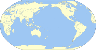
| Description | A blank map of the world centered at the 180E longitude line. |
| Date | (UTC) |
| Source | |
| Author |
|
| This is a retouched picture, which means that it has been digitally altered from its original version. Modifications: Colored map. The original can be viewed here: BlankMap-World-180E.svg:
|
I, the copyright holder of this work, hereby publish it under the following license:
| I, the copyright holder of this work, release this work into the public domain. This applies worldwide. In some countries this may not be legally possible; if so: I grant anyone the right to use this work for any purpose, without any conditions, unless such conditions are required by law. |
Original upload log
edit_(180E).svg&action=edit§ion=1)
This image is a derivative work of the following images:
- File:BlankMap-World-180E.svg licensed with PD-self
- 2008-04-13T22:24:07Z Lokal Profil 940x477 (3620359 Bytes) {{Information |Description=A blank map of the world centered at the 180E longitude line. Detailed SVG map with grouping enabled to connect all non-contiguous parts of a country's territory for easy colouring. Smaller count
Uploaded with derivativeFX
File history
Click on a date/time to view the file as it appeared at that time.
| Date/Time | Thumbnail | Dimensions | User | Comment | |
|---|---|---|---|---|---|
| current | 15:47, 6 March 2015 | | 3,100 × 1,600 (1.35 MB) | Milenioscuro (talk | contribs) | new color scheme |
| 02:05, 16 May 2011 |  | 3,100 × 1,600 (2.05 MB) | Milenioscuro (talk | contribs) | {{Information |Description=A blank map of the world centered at the 180E longitude line. |Source=*File:BlankMap-World-180E.svg |Date=2011-05-16 02:04 (UTC) |Author=*File:BlankMap-World-180E.svg: Lokal_Profil *derivative |
You cannot overwrite this file.
File usage on Commons
The following 4 pages use this file:
_(180E).svg&oldid=836986905)