File:Communes CA Périgourdine.png

Size of this preview: 503 × 600 pixels. Other resolutions: 201 × 240 pixels | 402 × 480 pixels | 644 × 768 pixels | 1,086 × 1,295 pixels.
Original file (1,086 × 1,295 pixels, file size: 194 KB, MIME type: image/png)
Captions
Captions
Add a one-line explanation of what this file represents
Summary edit
| Description |
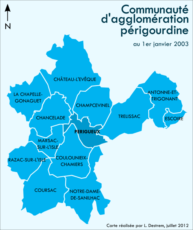
Français : Carte des communes de la Communauté d'agglomération périgourdine (Dordogne, France) |
| Date | |
| Source | Own work |
| Author | Babsy |
Licensing edit
I, the copyright holder of this work, hereby publish it under the following licenses:

|
Permission is granted to copy, distribute and/or modify this document under the terms of the GNU Free Documentation License, Version 1.2 or any later version published by the Free Software Foundation; with no Invariant Sections, no Front-Cover Texts, and no Back-Cover Texts. A copy of the license is included in the section entitled GNU Free Documentation License. |
This file is licensed under the Creative Commons Attribution 3.0 Unported license.
- You are free:
- to share – to copy, distribute and transmit the work
- to remix – to adapt the work
- Under the following conditions:
- attribution – You must give appropriate credit, provide a link to the license, and indicate if changes were made. You may do so in any reasonable manner, but not in any way that suggests the licensor endorses you or your use.
You may select the license of your choice.
File history
Click on a date/time to view the file as it appeared at that time.
| Date/Time | Thumbnail | Dimensions | User | Comment | |
|---|---|---|---|---|---|
| current | 10:36, 19 July 2012 | | 1,086 × 1,295 (194 KB) | Babsy (talk | contribs) | Correction d'une grosse erreur (retrait commune de Boulazac qui n'a jamais fait partie de la CAP) |
| 23:22, 12 January 2012 |  | 1,487 × 1,720 (232 KB) | Babsy (talk | contribs) | Retour à la version 2002-2011 (+ création fichier propre sur l'étendue de la CAP à partir de 2012) | |
| 16:48, 12 January 2012 |  | 1,244 × 1,294 (214 KB) | Babsy (talk | contribs) | Ajout des 3 nouvelles communes entrées dans la CAP en 2012. | |
| 10:54, 12 April 2011 |  | 1,487 × 1,720 (232 KB) | Babsy (talk | contribs) | {{Information |Description ={{fr|1=Carte des communes de la Communauté d'agglomération périgourdine (Dordogne, France)}} |Source ={{own}} |Author =Babsy |Date =12 avril 2011 |Permission = |other_versions |
You cannot overwrite this file.
File usage on Commons
There are no pages that use this file.
File usage on other wikis
The following other wikis use this file:
- Usage on fr.wikipedia.org