File:Compuerta and historic acequia (c5cab24d-3c05-4f91-81f2-b1a8a17445cd).JPG

Size of this preview: 450 × 600 pixels. Other resolutions: 180 × 240 pixels | 360 × 480 pixels | 576 × 768 pixels | 768 × 1,024 pixels | 1,536 × 2,048 pixels | 3,024 × 4,032 pixels.
Original file (3,024 × 4,032 pixels, file size: 5.56 MB, MIME type: image/jpeg)
Captions
Captions
Add a one-line explanation of what this file represents
Summary
edit.JPG&action=edit§ion=1)
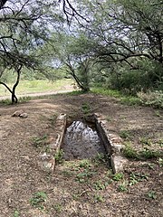
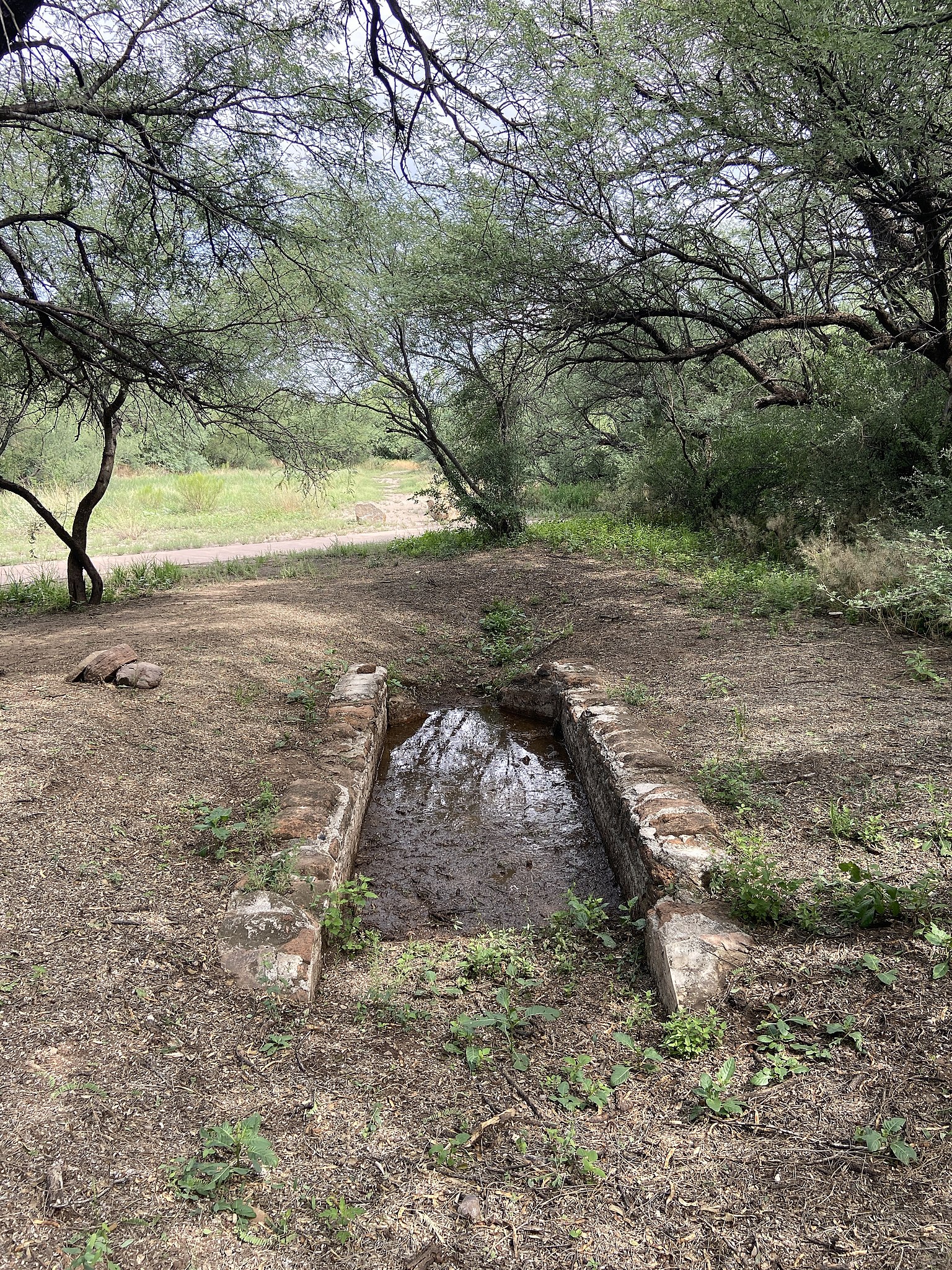
| English: Compuerta and historic acequia | ||||
|---|---|---|---|---|
| Photographer |
English: NPS Photo |
|||
| Title |
English: Compuerta and historic acequia |
|||
| Description |
English: shallow brick-lined rectangular structure with narrow neck at one end The compuerta acted as a check dam and holding area for water. Follow the line of the compuerta and trail beyond to see the original route of the acequia.
|
|||
| Depicted place |
English: Tumacacori National Historical Park, Santa Cruz County, Arizona |
|||
| Date | Taken on 22 August 2020 | |||
| Accession number | ||||
| Source |
English: NPGallery |
|||
| Permission (Reusing this file) |
|
|||
| NPS Unit Code | TUMA | |||
| Album(s) | English: Compuerta and Historic Acequia |
|||
File history
Click on a date/time to view the file as it appeared at that time.
| Date/Time | Thumbnail | Dimensions | User | Comment | |
|---|---|---|---|---|---|
| current | 01:03, 19 May 2021 | | 3,024 × 4,032 (5.56 MB) | BMacZeroBot (talk | contribs) | Batch upload (Commons:Batch uploading/NPGallery) |
You cannot overwrite this file.
File usage on Commons
The following page uses this file:
.JPG)
File usage on other wikis
The following other wikis use this file:
- Usage on en.wikipedia.org
.JPG&oldid=866847161)