File:Concept map Water and Its Patterns on Earth's Surface.jpg
Original file (1,500 × 526 pixels, file size: 111 KB, MIME type: image/jpeg)
Captions
Captions
Summary edit
| Description |
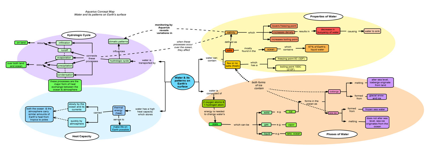
English: The concept map, Water and Its Patterns on Earth's Surface, highlights the relationships between salinity concepts. This approach aligns with the research from How People Learn (Bransford, Brown & Cocking, 2000) in assisting students to develop competence in an area of learning. Students must have both a deep foundation of factual knowledge and a strong conceptual framework. This allows students to organize information into meaningful patterns that can be used for future problem-solving. The map was developed in close alignment to the National Science Education Standards and the Benchmarks for Science Literacy documents.
Why use concept maps? In the teaching and learning of any science subject, concepts do not exist in isolation. Each concept depends on its relationships to others for meaning. A concept map provides clarity of meaning and integration of critical details. The construction of a concept map requires thinking in multiple directions and at varying levels of abstraction. In the process of identifying the key and associated concepts of a particular topic or sub-topic, one acquires a deeper understanding and clarification of any prior preconceptions. Essential concepts and relationships are broken into four branches Properties of Water, the Hydrologic Cycle, Phases of Water, and Heat Capacity. Click on the arrow to get a close up look at each of the branches. References
|
| Date | |
| Source | http://aquarius.nasa.gov/images/aquarius_cm_lg.jpg |
| Author | NASA |
Licensing edit
| This file is in the public domain in the United States because it was solely created by NASA. NASA copyright policy states that "NASA material is not protected by copyright unless noted". (See Template:PD-USGov, NASA copyright policy page or JPL Image Use Policy.) | ||
 |
Warnings:
|
File history
Click on a date/time to view the file as it appeared at that time.
| Date/Time | Thumbnail | Dimensions | User | Comment | |
|---|---|---|---|---|---|
| current | 22:53, 23 November 2008 | 1,500 × 526 (111 KB) | Mdd (talk | contribs) | {{Information |Description={{en|1=The concept map, Water and Its Patterns on Earth's Surface, highlights the relationships between salinity concepts. This approach aligns with the research from How People Learn (Bransford, Brown & Cocking, 2000) in assist |
You cannot overwrite this file.
File usage on Commons
There are no pages that use this file.
File usage on other wikis
The following other wikis use this file: