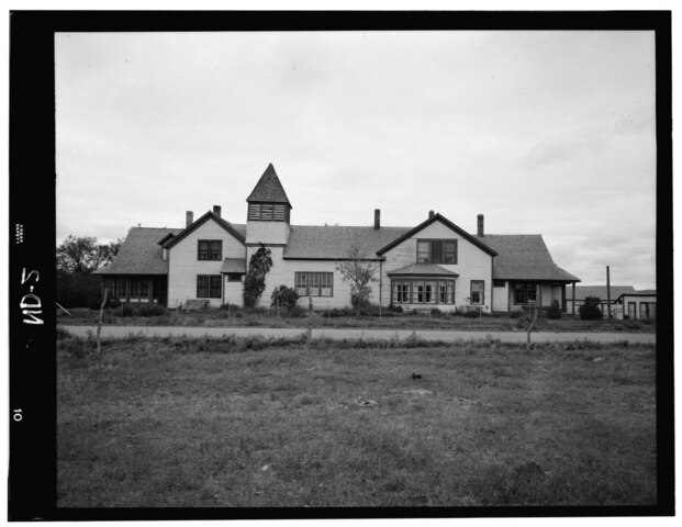
File:Congregational Mission, Fort Berthold Indian Reservation, White Shield, McLean County, ND HABS ND,28-ELBO,1-1.tif

Size of this JPG preview of this TIF file: 776 × 600 pixels. Other resolutions: 311 × 240 pixels | 621 × 480 pixels | 994 × 768 pixels | 1,280 × 989 pixels | 2,560 × 1,978 pixels | 5,000 × 3,863 pixels.
Original file (5,000 × 3,863 pixels, file size: 18.42 MB, MIME type: image/tiff)
Captions
Captions
Add a one-line explanation of what this file represents
Summary edit
| - Congregational Mission, Fort Berthold Indian Reservation, White Shield, McLean County, ND | ||||
|---|---|---|---|---|
| Photographer |
Related names:
|
|||
| Title |
- Congregational Mission, Fort Berthold Indian Reservation, White Shield, McLean County, ND |
|||
| Depicted place | North Dakota; McLean County; White Shield | |||
| Date | Documentation compiled after 1933 | |||
| Dimensions | 4 x 5 in. | |||
| Current location |
Library of Congress Prints and Photographs Division Washington, D.C. 20540 USA http://hdl.loc.gov/loc.pnp/pp.print |
|||
| Accession number |
HABS ND,28-ELBO,1-1 |
|||
| Credit line |
|
|||
| Notes |
|
|||
| Source | https://www.loc.gov/pictures/item/nd0002.photos.103022p | |||
| Permission (Reusing this file) |
|
|||

| Object location | | View this and other nearby images on: OpenStreetMap |
|---|
File history
Click on a date/time to view the file as it appeared at that time.
| Date/Time | Thumbnail | Dimensions | User | Comment | |
|---|---|---|---|---|---|
| current | 00:34, 29 July 2014 |  | 5,000 × 3,863 (18.42 MB) | Fæ (talk | contribs) | GWToolset: Creating mediafile for Fæ. HABS 24 July 2014 (2001:2300) |
You cannot overwrite this file.
File usage on Commons
The following 2 pages use this file: