File:Construction of river channel closing structure in the Mississippi NRRA (5fee5012-3a98-4137-96e6-33d8d8b5a945).jpg
Original file (2,272 × 1,704 pixels, file size: 841 KB, MIME type: image/jpeg)
Captions
Captions

|
The categories of this image need checking. You can do so here.
|
.jpg&action=edit&withJS=MediaWiki:Catcheck.js)
Summary
edit.jpg&action=edit§ion=1)
| English: Construction of river channel closing structure in the Mississippi NRRA | ||||
|---|---|---|---|---|
| Photographer |
English: NPS Staff |
|||
| Title |
English: Construction of river channel closing structure in the Mississippi NRRA |
|||
| Publisher |
English: U.S. National Park Service |
|||
| Description |
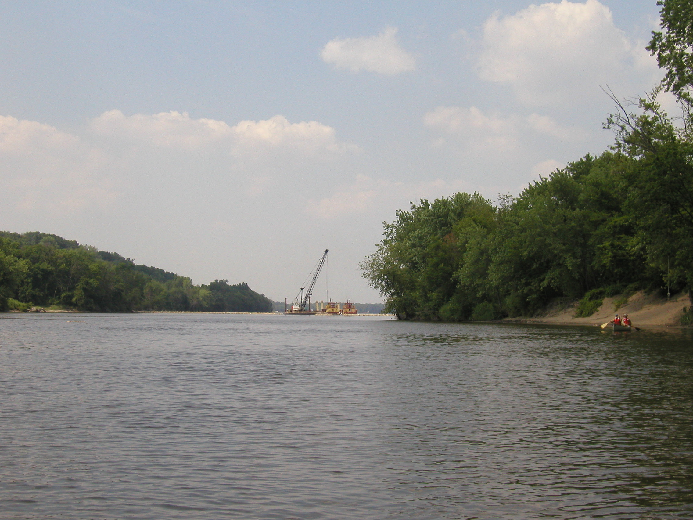
English: from back river channel on west side of island, facing upstream This series of photos was taken on July 12, 2005, on and near NPS Island 112-02 during a canoe safety training for new staff. The images depict construction by the U.S. Army Corps of Engineers of a partial closing structure made of riprap, dredged material and live plant material. The purpose of the structure is to control erosion on the upstream end of the island and to create new wildlife habitat. This project is part of the Corps' Channel Maintenance Management Plan. NPS Island 112-02 is located in Mississippi River Pool 2 at River Mile 827.5
|
|||
| Depicted place |
English: NPS Island 112-02, Mississippi National River and Recreation Area, Minnesota |
|||
| Date | Taken on 12 July 2005 | |||
| Accession number | ||||
| Source |
English: NPGallery |
|||
| Permission (Reusing this file) |
|
|||
| NPS Unit Code | MISS | |||
| Legacy NPS Focus Record ID | 233177 | |||
File history
Click on a date/time to view the file as it appeared at that time.
| Date/Time | Thumbnail | Dimensions | User | Comment | |
|---|---|---|---|---|---|
| current | 05:38, 2 July 2019 | | 2,272 × 1,704 (841 KB) | BMacZeroBot (talk | contribs) | Batch upload (Commons:Batch uploading/NPGallery) |
You cannot overwrite this file.
File usage on Commons
The following page uses this file:
.jpg)
.jpg&oldid=913268677)