File:Continent mycénien.svg

Size of this PNG preview of this SVG file: 646 × 599 pixels. Other resolutions: 259 × 240 pixels | 517 × 480 pixels | 828 × 768 pixels | 1,104 × 1,024 pixels | 2,208 × 2,048 pixels | 815 × 756 pixels.
Original file (SVG file, nominally 815 × 756 pixels, file size: 759 KB)
Captions
Captions
Add a one-line explanation of what this file represents
| Description |
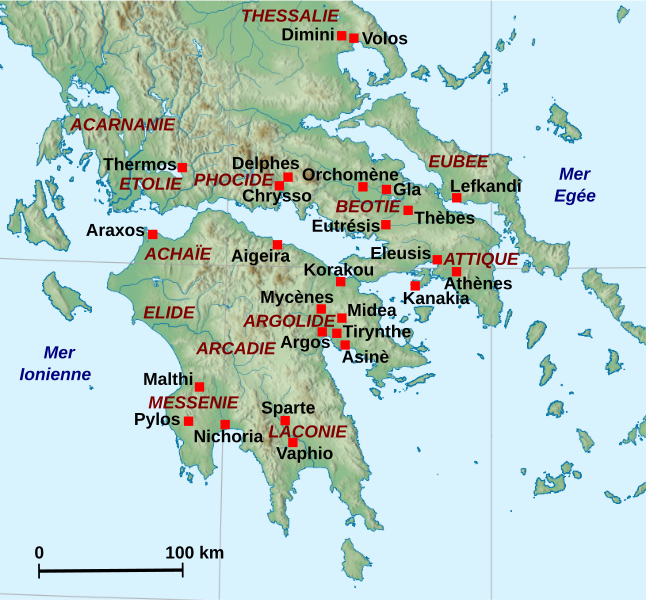
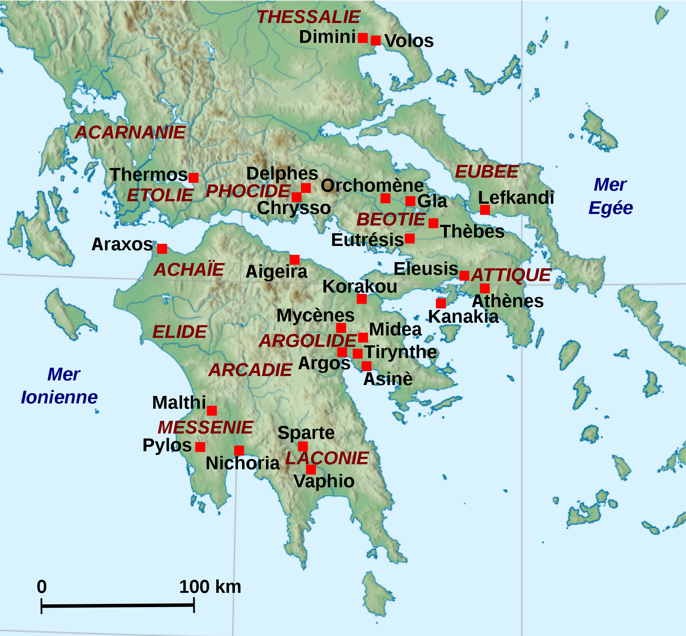
Français : Localisation des sites principaux de la période mycénienne en Grèce continentale méridionale.
English: Location map of the main archaeological sites of Mycenaean Continental Greece. |
| Date | (UTC) |
| Source | |
| Author |
|
| Other versions | Derivative works of this file: Continent mycénien.png |
| This is a retouched picture, which means that it has been digitally altered from its original version. Modifications: Ajout des sites archéologiques et régions.. The original can be viewed here: Greece large topographic basemap.svg:
|
I, the copyright holder of this work, hereby publish it under the following license:
| I, the copyright holder of this work, release this work into the public domain. This applies worldwide. In some countries this may not be legally possible; if so: I grant anyone the right to use this work for any purpose, without any conditions, unless such conditions are required by law. |
Original upload log edit
This image is a derivative work of the following images:
- File:Greece_large_topographic_basemap.svg licensed with PD-self
- 2009-09-06T18:25:11Z Future Perfect at Sunrise 2095x1971 (13850326 Bytes) added rivers and color scale
- 2009-09-01T13:21:10Z Future Perfect at Sunrise 2095x1971 (13030411 Bytes) some fixes
- 2009-08-30T08:26:30Z Future Perfect at Sunrise 2095x1971 (13933750 Bytes) reduced even further, still not displaying
- 2009-08-30T07:46:23Z Future Perfect at Sunrise 2095x1971 (22117639 Bytes) try smaller embedded bitmap, since previous version wouldn't display
- 2009-08-30T05:14:17Z Future Perfect at Sunrise 2095x1971 (30489498 Bytes) {{Information |Description={{en|1=Southern [[:en:Balkans|Balkans]] (incl. [[:en:Greece|Greece]], [[:en:Albania|Albania]], [[:en:Republic of Macedonia|Macedonia]]), [[:en:Aegean Sea|Aegean]] and western [[:en:Anatolia|Anatolia
Uploaded with derivativeFX
File history
Click on a date/time to view the file as it appeared at that time.
| Date/Time | Thumbnail | Dimensions | User | Comment | |
|---|---|---|---|---|---|
| current | 18:54, 13 November 2010 | | 815 × 756 (759 KB) | Zunkir (talk | contribs) | Plus de sites et régions. |
| 18:51, 13 November 2010 |  | 815 × 756 (747 KB) | Zunkir (talk | contribs) | {{Information |Description={{fr|1=Localisation des sites principaux de la période mycénienne en Grèce continentale méridionale.}} {{en|1=Location map of the main archaeological sites of Mycenaean Continental Greece.}} |Source=*[[:File:Greece_large_top |
You cannot overwrite this file.
File usage on Commons
The following page uses this file: