File:CoochsBridge1777.jpg

Original file (2,516 × 2,072 pixels, file size: 1.13 MB, MIME type: image/jpeg)
Captions
Captions
Summary edit
| DescriptionCoochsBridge1777.jpg |
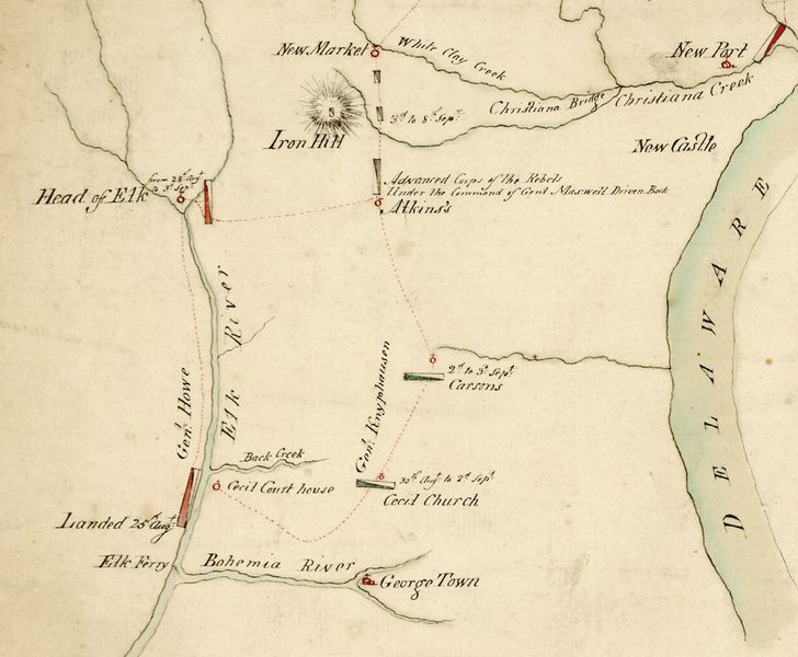
English: Detail of a period military map depicting the preliminary British movements in the 1777 Philadelphia campaign in Maryland and Delaware, including the site (near Iron Hill) of the Battle of Cooch's Bridge. |
||||||||||||||||||||
| Date |
circa 1777 date QS:P,+1777-00-00T00:00:00Z/9,P1480,Q5727902 |
||||||||||||||||||||
| Source |
|
||||||||||||||||||||
| Author |
creator QS:P170,Q3182107 |
||||||||||||||||||||
Licensing edit
| Public domainPublic domainfalsefalse |
|
This work is in the public domain in its country of origin and other countries and areas where the copyright term is the author's life plus 100 years or fewer. | |
| This file has been identified as being free of known restrictions under copyright law, including all related and neighboring rights. | |
https://creativecommons.org/publicdomain/mark/1.0/PDMCreative Commons Public Domain Mark 1.0falsefalse
File history
Click on a date/time to view the file as it appeared at that time.
| Date/Time | Thumbnail | Dimensions | User | Comment | |
|---|---|---|---|---|---|
| current | 16:46, 12 August 2010 |  | 2,516 × 2,072 (1.13 MB) | Magicpiano (talk | contribs) | {{Information |Description={{en|Detail of a period military map depicting the preliminary British movements in the 1777 w:Philadelphia campaign in Maryland and Delaware, including the site (near Iron Hill) of the w:Battle of Cooch's Bridge.}} |S |
You cannot overwrite this file.
File usage on Commons
There are no pages that use this file.
File usage on other wikis
The following other wikis use this file:
- Usage on en.wikipedia.org
- Usage on ja.wikipedia.org
- Usage on pl.wikipedia.org
- Usage on ru.wikipedia.org
- Usage on www.wikidata.org
Metadata
This file contains additional information such as Exif metadata which may have been added by the digital camera, scanner, or software program used to create or digitize it. If the file has been modified from its original state, some details such as the timestamp may not fully reflect those of the original file. The timestamp is only as accurate as the clock in the camera, and it may be completely wrong.
| _error | 0 |
|---|

