File:Copenhagen bus line 650S 2004.png
No higher resolution available.
Copenhagen_bus_line_650S_2004.png (700 × 550 pixels, file size: 501 KB, MIME type: image/png)
Captions
Captions
Add a one-line explanation of what this file represents
Summary edit
| Description |
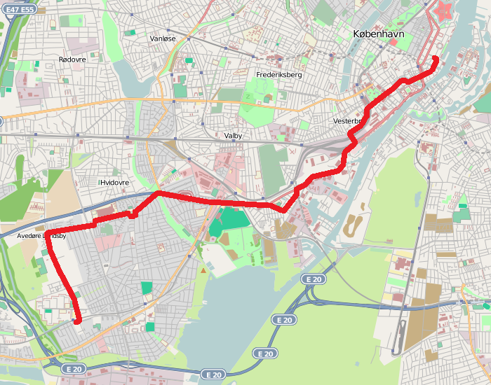
English: Map of Copenhagen bus line 650S between Avedøre Station and Sankt Annæ Plads as of october 2004, when the line was closed. |
| Date | |
| Source | Own work based on File:Map of Copenhagen with surroundings.png |
| Author | Leif Jørgensen |
Licensing edit
I, the copyright holder of this work, hereby publish it under the following license:
This file is licensed under the Creative Commons Attribution-Share Alike 4.0 International license.
- You are free:
- to share – to copy, distribute and transmit the work
- to remix – to adapt the work
- Under the following conditions:
- attribution – You must give appropriate credit, provide a link to the license, and indicate if changes were made. You may do so in any reasonable manner, but not in any way that suggests the licensor endorses you or your use.
- share alike – If you remix, transform, or build upon the material, you must distribute your contributions under the same or compatible license as the original.
File history
Click on a date/time to view the file as it appeared at that time.
| Date/Time | Thumbnail | Dimensions | User | Comment | |
|---|---|---|---|---|---|
| current | 11:10, 22 October 2015 | | 700 × 550 (501 KB) | Dannebrog Spy (talk | contribs) | {{Information |description={{en|1=Map of Copenhagen bus line 650S between Avedøre Station and Sankt Annæ Plads as of october 2004, when the line was closed.}} |date=2015-10-21 |source=Own work based on [[:File:Map of Copenhagen with surroundings.png]... |
You cannot overwrite this file.
File usage on Commons
The following 3 pages use this file:
File usage on other wikis
The following other wikis use this file:
- Usage on da.wikipedia.org
- Usage on www.wikidata.org