File:Cornwall UK mainland electoral division map 2013 (blank).svg

Size of this PNG preview of this SVG file: 618 × 599 pixels. Other resolutions: 247 × 240 pixels | 495 × 480 pixels | 792 × 768 pixels | 1,056 × 1,024 pixels | 2,112 × 2,048 pixels | 1,224 × 1,187 pixels.
Original file (SVG file, nominally 1,224 × 1,187 pixels, file size: 1.65 MB)
Captions
Captions
Add a one-line explanation of what this file represents
| Description |
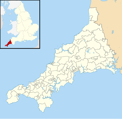
Blank map of Cornwall, UK (excluding the Isles of Scilly) with electoral divisions in 2013 shown. Equirectangular map projection on WGS 84 datum, with N/S stretched 150% Geographic limits:
|
| Date | |
| Source |
|
| Author | Nilfanion, created using Ordnance Survey data |
| Permission (Reusing this file) |
This file is licensed under the Creative Commons Attribution-Share Alike 3.0 Unported license. Attribution: Contains Ordnance Survey data © Crown copyright and database right
|
File history
Click on a date/time to view the file as it appeared at that time.
| Date/Time | Thumbnail | Dimensions | User | Comment | |
|---|---|---|---|---|---|
| current | 10:50, 3 June 2013 | | 1,224 × 1,187 (1.65 MB) | Nilfanion (talk | contribs) | {{Information |Description=Blank map of Cornwall, UK (excluding the Isles of Scilly) with electoral divisions in 2013 shown. Equirectangular map projection on WGS 84 datum, with N/S stretched 150% Geographic limits: *West: 5.8W *East: ... |
You cannot overwrite this file.
File usage on Commons
More than 100 pages use this file. The following list shows the first 100 pages that use this file only. A full list is available.
.svg)
- User:Nilfanion/Maps/Elections
- Commons:Graphic Lab/Map workshop/Archive/2021
- File:Altarnun electoral division map 2013.svg
- File:Bodmin St Leonard electoral division map 2013.svg
- File:Bodmin St Mary's electoral division map 2013.svg
- File:Bodmin St Petroc electoral division map 2013.svg
- File:Breage, Germoe and Sithney electoral division map 2013.svg
- File:Bude electoral division map 2013.svg
- File:Bugle electoral division map 2013.svg
- File:Callington electoral division map 2013.svg
- File:Camborne Pendarves electoral division map 2013.svg
- File:Camborne Roskear electoral division map 2013.svg
- File:Camborne Trelowarren electoral division map 2013.svg
- File:Camborne Treslothan electoral division map 2013.svg
- File:Camborne Treswithian electoral division map 2013.svg
- File:Camelford electoral division map 2013.svg
- File:Carharrack, Gwennap and St Day electoral division map 2013.svg
- File:Chacewater, Kenwyn and Baldhu electoral division map 2013.svg
- File:Constantine, Mawnan and Budock electoral division map 2013.svg
- File:Cornwall Council political divisions August 2016 map.svg
- File:Cornwall Council political divisions December 2013 map.svg
- File:Cornwall Council political divisions December 2014 map.svg
- File:Cornwall Council political divisions March 2018 map.svg
- File:Cornwall Council political divisions May 2017 map.svg
- File:Cornwall UK local election 2013 map.svg
- File:Crowan and Wendron electoral division map 2013.svg
- File:Falmouth Arwenack electoral division map 2013.svg
- File:Falmouth Boslowick electoral division map 2013.svg
- File:Falmouth Penwerris electoral division map 2013.svg
- File:Falmouth Smithick electoral division map 2013.svg
- File:Falmouth Trescobeas electoral division map 2013.svg
- File:Feock and Playing Place electoral division map 2013.svg
- File:Four Lanes electoral division map 2013.svg
- File:Fowey and Tywardreath electoral division map 2013.svg
- File:Grenville and Stratton electoral division map 2013.svg
- File:Gulval and Heamoor electoral division map 2013.svg
- File:Gunnislake and Calstock electoral division map 2013.svg
- File:Gwinear-Gwithian and St Erth electoral division map 2013.svg
- File:Hayle North electoral division map 2013.svg
- File:Hayle South electoral division map 2013.svg
- File:Helston North electoral division map 2013.svg
- File:Helston South electoral division map 2013.svg
- File:Illogan electoral division map 2013.svg
- File:Ladock, St Clement and St Erme electoral division map 2013.svg
- File:Lanivet and Blisland electoral division map 2013.svg
- File:Lanner and Stithians electoral division map 2013.svg
- File:Launceston Central electoral division map 2013.svg
- File:Launceston North and North Petherwin electoral division map 2013.svg
- File:Launceston South electoral division map 2013.svg
- File:Lelant and Carbis Bay electoral division map 2013.svg
- File:Liskeard East electoral division map 2013.svg
- File:Liskeard North electoral division map 2013.svg
- File:Liskeard West and Dobwalls electoral division map 2013.svg
- File:Looe East electoral division map 2013.svg
- File:Looe West, Lansallos and Lanteglos electoral division map 2013.svg
- File:Lostwithiel electoral division map 2013.svg
- File:Ludgvan electoral division map 2013.svg
- File:Lynher electoral division map 2013.svg
- File:Mabe, Perranarworthal and St Gluvias electoral division map 2013.svg
- File:Marazion and Perranuthnoe electoral division map 2013.svg
- File:Menheniot electoral division map 2013.svg
- File:Mevagissey electoral division map 2013.svg
- File:Mount Charles electoral division map 2013.svg
- File:Mount Hawke and Portreath electoral division map 2013.svg
- File:Mullion and Grade-Ruan electoral division map 2013.svg
- File:Newlyn and Goonhavern electoral division map 2013.svg
- File:Newlyn and Mousehole electoral division map 2013.svg
- File:Newquay Central electoral division map 2013.svg
- File:Newquay Pentire electoral division map 2013.svg
- File:Newquay Treloggan electoral division map 2013.svg
- File:Newquay Tretherras electoral division map 2013.svg
- File:Newquay Treviglas electoral division map 2013.svg
- File:Padstow electoral division map 2013.svg
- File:Par and St Blazey Gate electoral division map 2013.svg
- File:Penryn East and Mylor electoral division map 2013.svg
- File:Penryn West electoral division map 2013.svg
- File:Penwithick and Boscoppa electoral division map 2013.svg
- File:Penzance Central electoral division map 2013.svg
- File:Penzance East electoral division map 2013.svg
- File:Penzance Promenade electoral division map 2013.svg
- File:Perranporth electoral division map 2013.svg
- File:Pool and Tehidy electoral division map 2013.svg
- File:Porthleven and Helston West electoral division map 2013.svg
- File:Poundstock electoral division map 2013.svg
- File:Probus, Tregony and Grampound electoral division map 2013.svg
- File:Rame Peninsula electoral division map 2013.svg
- File:Redruth Central electoral division map 2013.svg
- File:Roseland electoral division map 2013.svg
- File:St Agnes electoral division map 2013.svg
- File:St Buryan electoral division map 2013.svg
- File:St Cleer electoral division map 2013.svg
- File:St Columb Major electoral division map 2013.svg
- File:St Dominick, Harrowbarrow and Kelly Bray electoral division map 2013.svg
- File:St Enoder electoral division map 2013.svg
- File:St Issey and St Tudy electoral division map 2013.svg
- File:St Ives West electoral division map 2013.svg
- File:St Just in Penwith electoral division map 2013.svg
- File:St Keverne and Meneage electoral division map 2013.svg
- File:St Mawgan and Colan electoral division map 2013.svg
- File:St Stephen-in-Brannel electoral division map 2013.svg
View more links to this file.
File usage on other wikis
The following other wikis use this file:
- Usage on en.wikipedia.org
- Usage on sc.wikipedia.org
.svg&oldid=868504893)