File:Cornwall outline map with UK.png

Size of this preview: 758 × 600 pixels. Other resolutions: 303 × 240 pixels | 607 × 480 pixels | 971 × 768 pixels | 1,280 × 1,013 pixels | 1,351 × 1,069 pixels.
Original file (1,351 × 1,069 pixels, file size: 121 KB, MIME type: image/png)
Captions
Captions
Add a one-line explanation of what this file represents
Summary edit
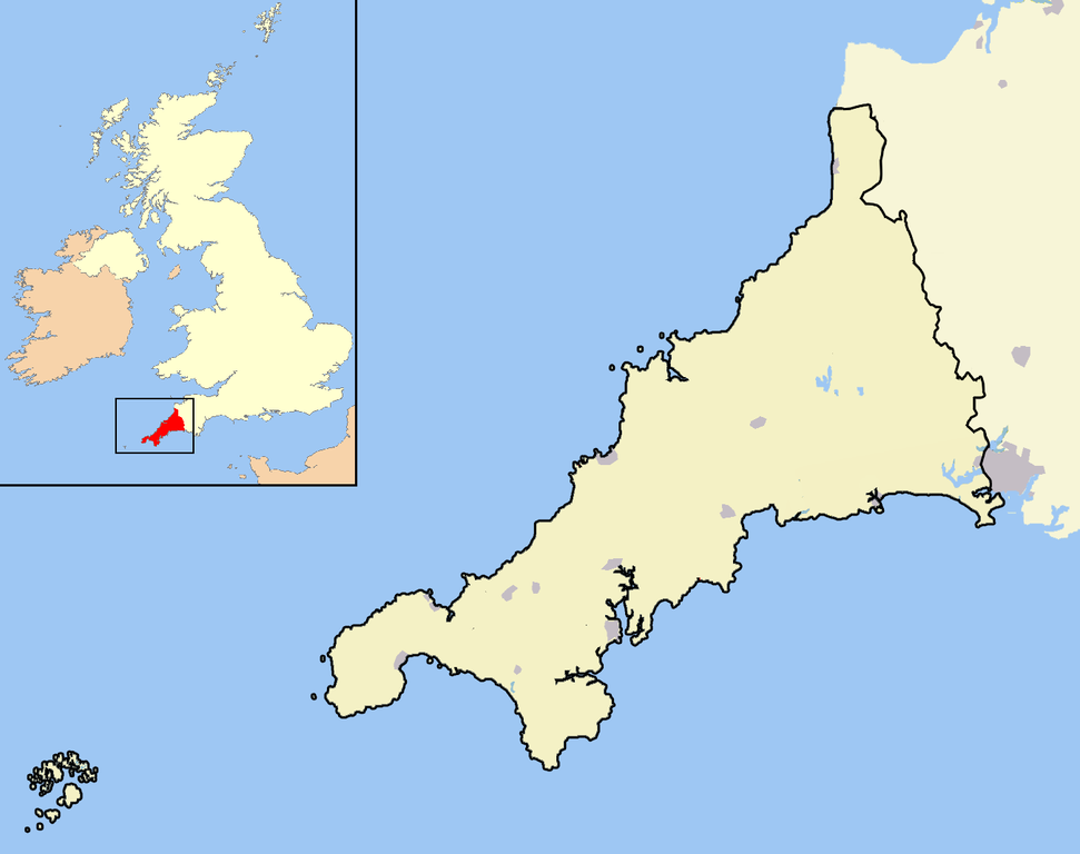
| Description | A map of the county of Cornwall, England, United Kingdom, showing the post-2009 district boundaries. |
| Date | |
| Source | Own work |
| Author | Jhamez84 |
Licensing edit
| I, the copyright holder of this work, release this work into the public domain. This applies worldwide. In some countries this may not be legally possible; if so: I grant anyone the right to use this work for any purpose, without any conditions, unless such conditions are required by law. |
File history
Click on a date/time to view the file as it appeared at that time.
| Date/Time | Thumbnail | Dimensions | User | Comment | |
|---|---|---|---|---|---|
| current | 15:17, 5 April 2009 | | 1,351 × 1,069 (121 KB) | Warofdreams (talk | contribs) | |
| 14:03, 18 December 2007 |  | 1,351 × 1,069 (149 KB) | Jza84 (talk | contribs) | Standardising some aesthetics | |
| 23:12, 17 April 2007 |  | 1,351 × 1,069 (97 KB) | RichardB (talk | contribs) | ||
| 22:52, 17 April 2007 |  | 1,300 × 1,078 (134 KB) | RichardB (talk | contribs) | ||
| 22:32, 17 April 2007 |  | 1,361 × 1,078 (98 KB) | RichardB (talk | contribs) | ||
| 14:58, 14 April 2007 |  | 1,546 × 1,180 (106 KB) | RichardB (talk | contribs) | ||
| 14:17, 14 April 2007 |  | 1,546 × 1,180 (109 KB) | RichardB (talk | contribs) | An outline map of Cornwall for use within templates on Wikipedia. Own work - created 14th April 2007 - coastline and town position data derived from the OpenStreetMap project. District and county boundaries derived from the New Popular Edition Ordnance S |
You cannot overwrite this file.
File usage on Commons
There are no pages that use this file.
File usage on other wikis
The following other wikis use this file:
- Usage on en.wikipedia.org
- Usage on eo.wikipedia.org
- Usage on hy.wikipedia.org
- Usage on ml.wikipedia.org
- Usage on pl.wikipedia.org
- Usage on tr.wikipedia.org