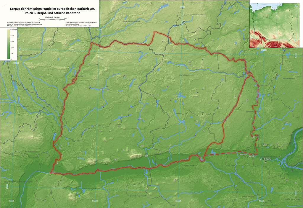
File:Corpus der römischen Funde im europäischen Barbaricum. Polen 6. Krajna (map 1 to 200,000) 01.jpg

Size of this preview: 800 × 551 pixels. Other resolutions: 320 × 220 pixels | 640 × 441 pixels | 1,024 × 705 pixels | 1,280 × 881 pixels | 2,560 × 1,763 pixels | 9,606 × 6,614 pixels.
Original file (9,606 × 6,614 pixels, file size: 4.78 MB, MIME type: image/jpeg)
Captions
Captions
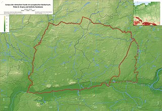
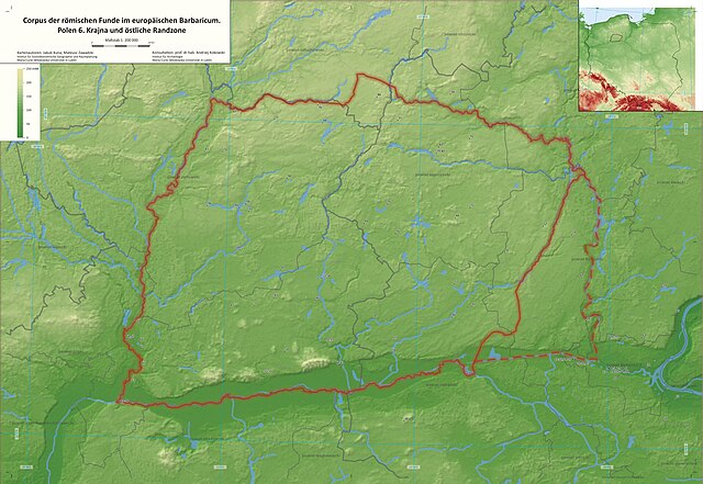
Corpus of Roman finds in the European Barbaricum. Poland 6. Krajna (map)
Summary
edit_01.jpg&action=edit§ion=1)
| Warning | The original file is very high-resolution. It might not load properly or could cause your browser to freeze when opened at full size. |
|---|
_01.jpg&flash=no)
| Camera location | | View this and other nearby images on: OpenStreetMap |
|---|
_01.jpg¶ms=053.300000_N_0017.300000_E_globe:Earth_type:camera_heading:0.00&language=en)
Licensing
edit_01.jpg&action=edit§ion=2)
I, the copyright holder of this work, hereby publish it under the following license:
This file is licensed under the Creative Commons Attribution-Share Alike 4.0 International license.
- You are free:
- to share – to copy, distribute and transmit the work
- to remix – to adapt the work
- Under the following conditions:
- attribution – You must give appropriate credit, provide a link to the license, and indicate if changes were made. You may do so in any reasonable manner, but not in any way that suggests the licensor endorses you or your use.
- share alike – If you remix, transform, or build upon the material, you must distribute your contributions under the same or compatible license as the original.
File history
Click on a date/time to view the file as it appeared at that time.
| Date/Time | Thumbnail | Dimensions | User | Comment | |
|---|---|---|---|---|---|
| current | 15:28, 10 July 2024 | | 9,606 × 6,614 (4.78 MB) | Jakub Kuna (talk | contribs) | Uploaded own work with UploadWizard |
You cannot overwrite this file.
File usage on Commons
There are no pages that use this file.
_01.jpg&oldid=896475641)