File:Corral Fire via Landsat 9 on 2024-06-02.jpg
Size of this preview: 800 × 533 pixels. Other resolutions: 320 × 213 pixels | 640 × 427 pixels | 1,044 × 696 pixels.
Original file (1,044 × 696 pixels, file size: 380 KB, MIME type: image/jpeg)
Captions
Captions
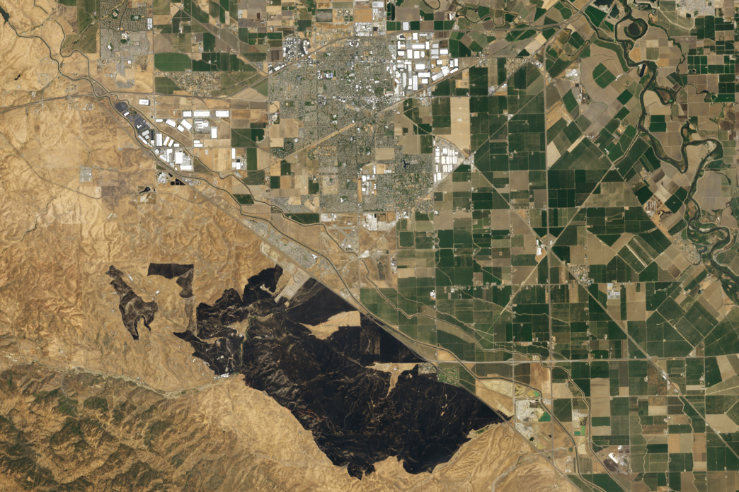
The burn scar of the Corral Fire in California's Central Valley (San Joaquin County) seen by the Landsat 9 satellite on June 2, 2024
Summary
edit
| Description |
English: The burn scar of the Corral Fire in California's Central Valley (San Joaquin County) seen by the Landsat 9 satellite on June 2, 2024 |
| Date | |
| Source | https://earthobservatory.nasa.gov/images/152897/grass-fire-chars-california |
| Author | NASA Earth Observatory images by Wanmei Liang, using Landsat data from the U.S. Geological Survey |
Licensing
edit
| This file is in the public domain in the United States because it was solely created by NASA. NASA copyright policy states that "NASA material is not protected by copyright unless noted". (See Template:PD-USGov, NASA copyright policy page or JPL Image Use Policy.) | ||
 |
Warnings:
|
File history
Click on a date/time to view the file as it appeared at that time.
| Date/Time | Thumbnail | Dimensions | User | Comment | |
|---|---|---|---|---|---|
| current | 13:38, 7 June 2024 | | 1,044 × 696 (380 KB) | Penitentes (talk | contribs) | Uploaded a work by NASA Earth Observatory images by Wanmei Liang, using Landsat data from the U.S. Geological Survey from https://earthobservatory.nasa.gov/images/152897/grass-fire-chars-california with UploadWizard |
You cannot overwrite this file.
File usage on Commons
There are no pages that use this file.
File usage on other wikis
The following other wikis use this file:
- Usage on en.wikipedia.org