File:Couleur politique des maires sortants 2014-2020 du Rhône.png

Size of this preview: 449 × 599 pixels. Other resolutions: 180 × 240 pixels | 360 × 480 pixels | 576 × 768 pixels | 768 × 1,024 pixels | 1,535 × 2,048 pixels | 4,167 × 5,558 pixels.
Original file (4,167 × 5,558 pixels, file size: 1.45 MB, MIME type: image/png)
Captions
Captions
Add a one-line explanation of what this file represents
Summary
edit
| Description |
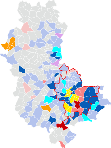
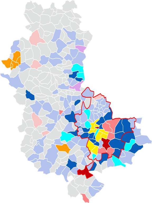
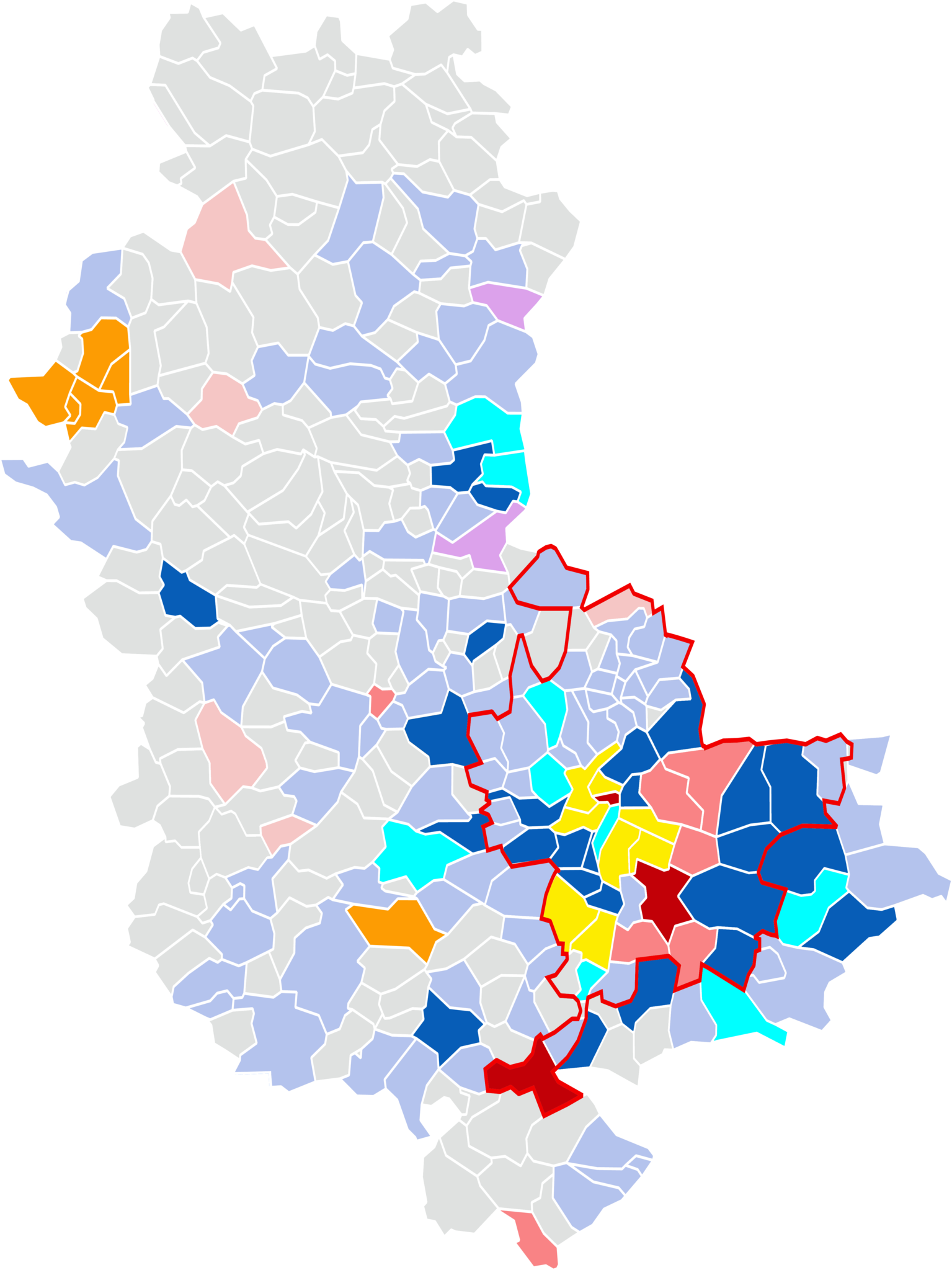
Français : Couleur politique des maires sortants 2014-2020 du Rhône. |
| Date | |
| Source | Adaptation de la carte suivante : https://commons.wikimedia.org/wiki/File:Blank_Map_of_Rh%C3%B4ne_Department,_France,_with_Communes_and_Border_Changes_1793-2015.svg?uselang=fr |
| Author | Jfblanc |
Couleurs attribuées à partir de cette carte (https://www.lepoint.fr/elections-municipales/consultez-notre-carte-de-france-interactive-des-resultats-23-03-2014-1804351_1966.php), actualisée avec la couleur politique des maires sortants indiquées sur cette page : https://fr.wikipedia.org/wiki/%C3%89lections_municipales_de_2020_dans_le_Rh%C3%B4ne_et_la_m%C3%A9tropole_de_Lyon
Licensing
edit
This file is licensed under the Creative Commons Attribution-Share Alike 4.0 International license.
- You are free:
- to share – to copy, distribute and transmit the work
- to remix – to adapt the work
- Under the following conditions:
- attribution – You must give appropriate credit, provide a link to the license, and indicate if changes were made. You may do so in any reasonable manner, but not in any way that suggests the licensor endorses you or your use.
- share alike – If you remix, transform, or build upon the material, you must distribute your contributions under the same or compatible license as the original.
File history
Click on a date/time to view the file as it appeared at that time.
| Date/Time | Thumbnail | Dimensions | User | Comment | |
|---|---|---|---|---|---|
| current | 17:28, 26 June 2020 | | 4,167 × 5,558 (1.45 MB) | Bastien Choulans (talk | contribs) | Changement de la couleur de certaines communes. |
| 14:26, 26 June 2020 |  | 4,167 × 5,558 (1.46 MB) | Bastien Choulans (talk | contribs) | Uploaded a work by Jfblanc from Adaptation de la carte suivante : https://commons.wikimedia.org/wiki/File:Blank_Map_of_Rh%C3%B4ne_Department,_France,_with_Communes_and_Border_Changes_1793-2015.svg?uselang=fr with UploadWizard |
You cannot overwrite this file.
File usage on Commons
There are no pages that use this file.
File usage on other wikis
The following other wikis use this file:
- Usage on fr.wikipedia.org