File:County of Hoorne.png
County_of_Hoorne.png (332 × 318 pixels, file size: 214 KB, MIME type: image/png)
Captions
Captions
Summary
edit
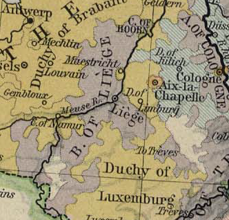
| Description | Map showing the Prince-Bishopric of Liège and the County of Horne |
| Date | |
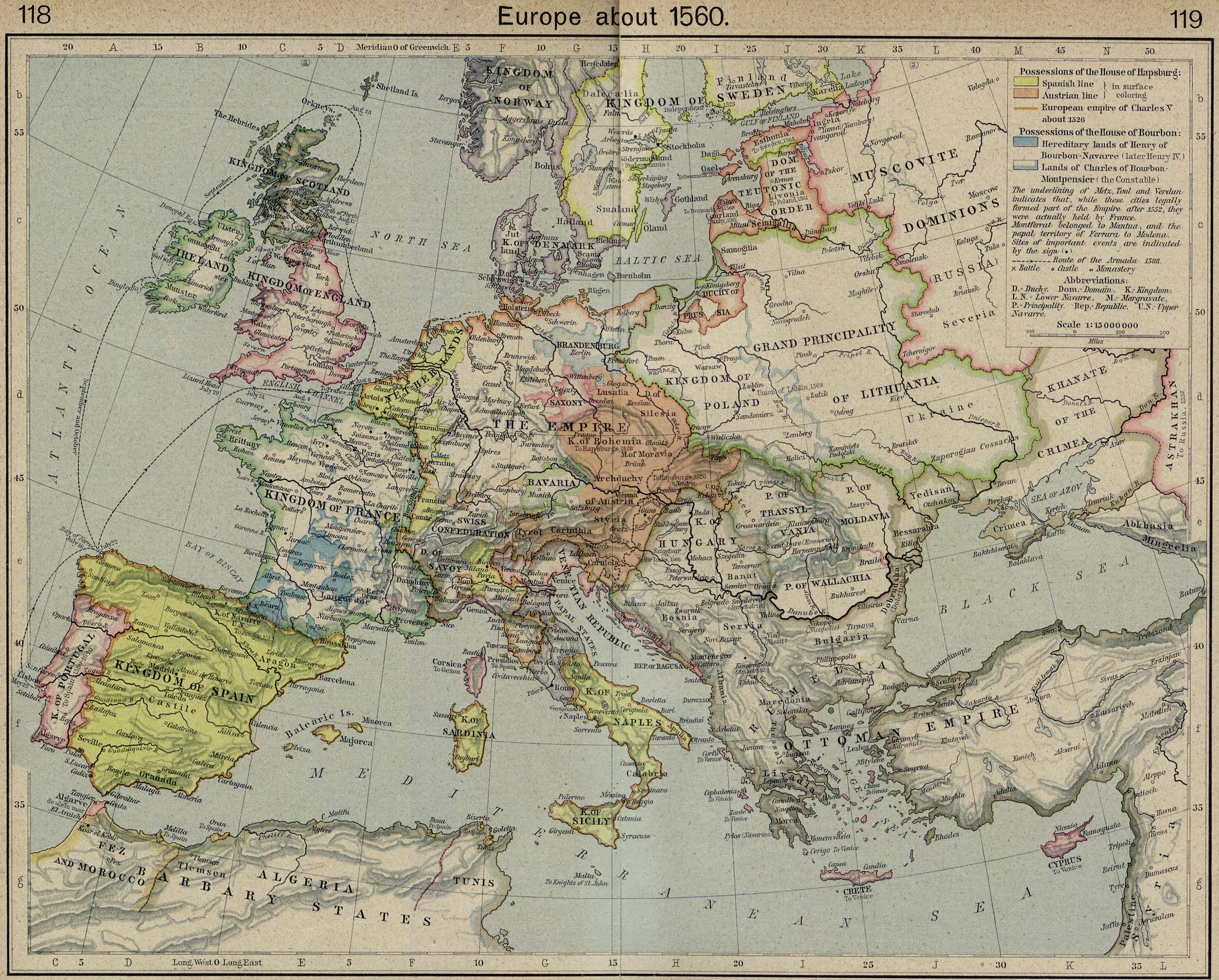
| Source | Excerpted from Europe about 1560. From The Historical Atlas by William R. Shepherd, 1923 |
| Author | William R. Shepherd |
Licensing
edit
|
This work is in the public domain in its country of origin and other countries and areas where the copyright term is the author's life plus 70 years or fewer.
| |
| This file has been identified as being free of known restrictions under copyright law, including all related and neighboring rights. | |
File history
Click on a date/time to view the file as it appeared at that time.
| Date/Time | Thumbnail | Dimensions | User | Comment | |
|---|---|---|---|---|---|
| current | 22:57, 16 May 2007 | | 332 × 318 (214 KB) | OwenBlacker (talk | contribs) | {{Information |Description=Map showing the en:Prince-Bishopric of Liège and the en:County of Horne |Source=Excerpted from [http://www.lib.utexas.edu/maps/historical/shepherd/europe_1560.jpg Europe about 1560. From The Historical Atlas by Will |
You cannot overwrite this file.
File usage on Commons
The following page uses this file:
File usage on other wikis
The following other wikis use this file:
- Usage on bg.wikipedia.org
- Usage on br.wikipedia.org
- Usage on fr.wikipedia.org
- Usage on li.wikipedia.org
- Usage on nl.wikipedia.org
- Usage on wa.wikipedia.org
- Usage on www.wikidata.org