File:CrawfishValleyWV Bluefield 701692 1981 100000 geoScaledAreaUpdate.png
Size of this preview: 800 × 540 pixels. Other resolutions: 320 × 216 pixels | 640 × 432 pixels | 1,024 × 691 pixels | 1,280 × 864 pixels | 2,033 × 1,372 pixels.
Original file (2,033 × 1,372 pixels, file size: 5.61 MB, MIME type: image/png)
Captions
Captions
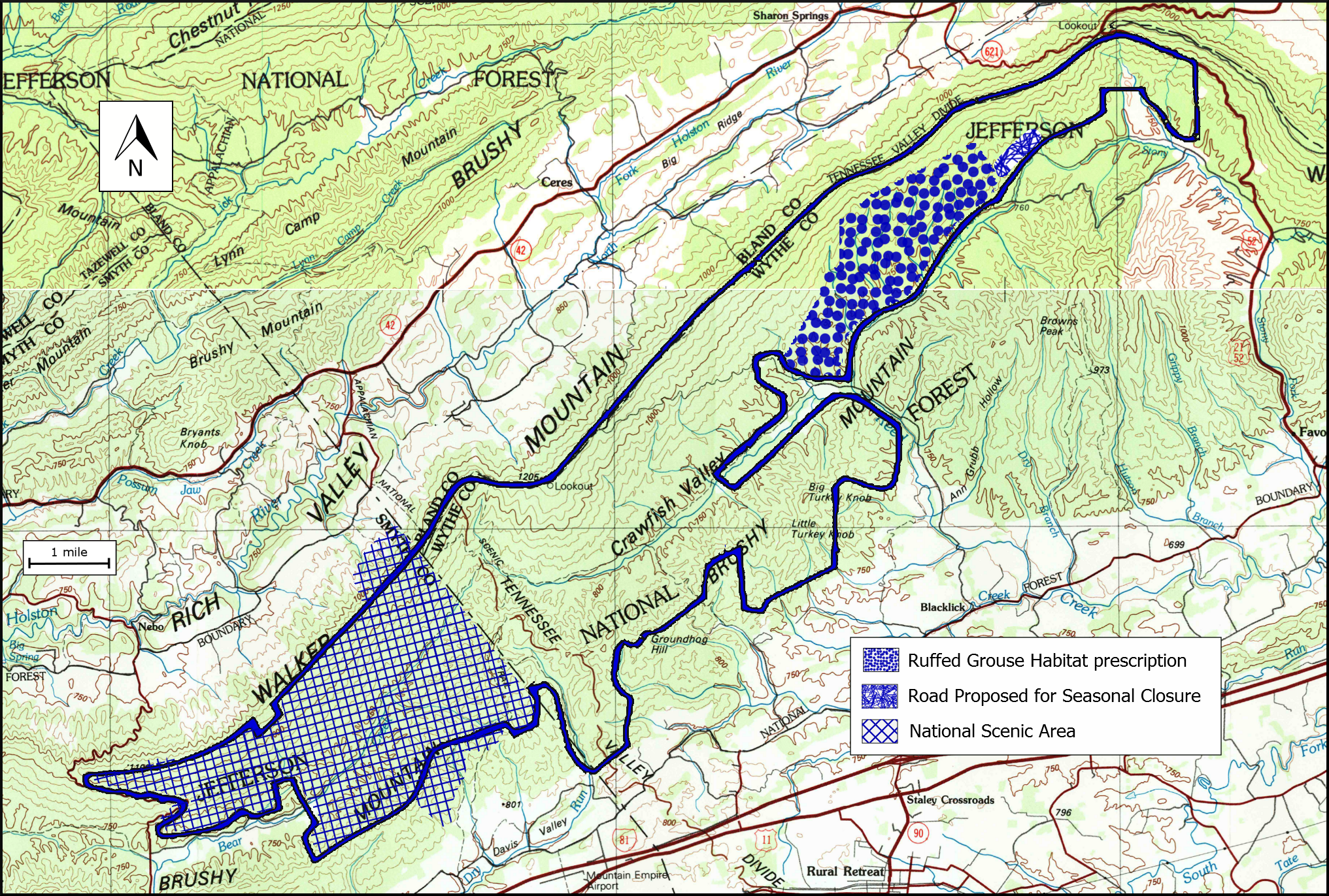
Boundary of the Crawfish Valley wildland in the Jefferson National Forest as identified by the Wilderness Society
Summary edit
| Description |
English: Boundary of the Crawfish Valley wildland in the Jefferson National Forest as identified by the Wilderness Society |
| Date | |
| Source |
the files were created by drawing a boundary on a scanned image of the US Geological Survey map "WV Bluefield 701692 1981 100000 geo” . A jpg file of the original image is  |
| Author | US Geological Survey |
Licensing edit
This image is in the public domain in the United States because it only contains materials that originally came from the United States Geological Survey, an agency of the United States Department of the Interior. For more information, see the official USGS copyright policy.
|
File history
Click on a date/time to view the file as it appeared at that time.
| Date/Time | Thumbnail | Dimensions | User | Comment | |
|---|---|---|---|---|---|
| current | 23:58, 7 May 2019 | | 2,033 × 1,372 (5.61 MB) | WilderAddict (talk | contribs) | User created page with UploadWizard |
You cannot overwrite this file.
File usage on Commons
There are no pages that use this file.
File usage on other wikis
The following other wikis use this file:
- Usage on en.wikipedia.org