File:Crown Grant Map - Jacobs River Hundred, Part Blocks I - VI, XVII - XIX.jpg

Size of this preview: 635 × 600 pixels. Other resolutions: 254 × 240 pixels | 508 × 480 pixels | 813 × 768 pixels | 1,085 × 1,024 pixels | 2,169 × 2,048 pixels | 10,559 × 9,969 pixels.
Original file (10,559 × 9,969 pixels, file size: 8.37 MB, MIME type: image/jpeg)
Captions
Captions
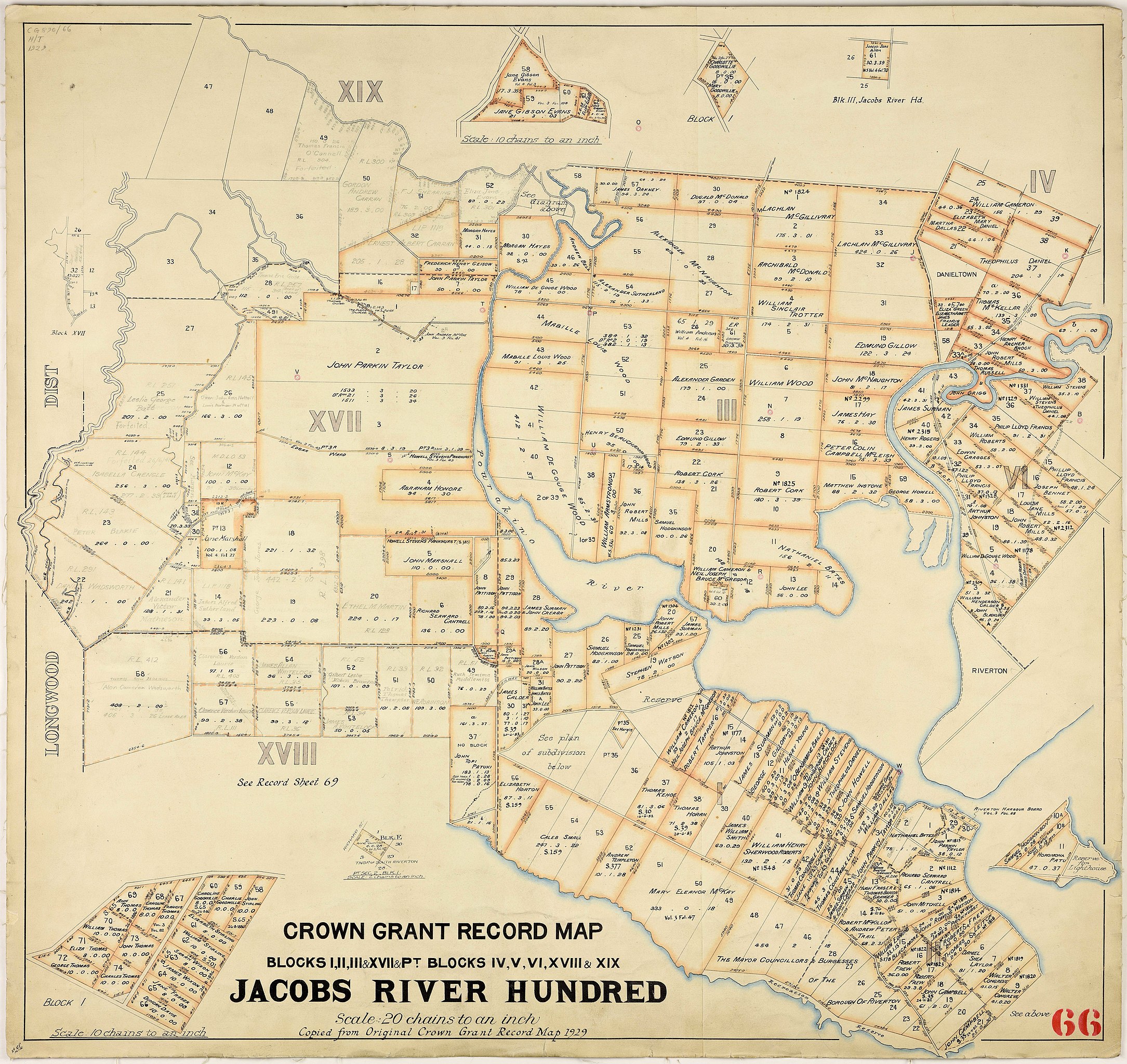
Crown Grant Map - Jacobs River Hundred, Part Blocks I - VI, XVII - XIX (1929)
Summary
edit
| Warning | The original file is very high-resolution. It might not load properly or could cause your browser to freeze when opened at full size. |
|---|
| Description |
English: Crown Grant Map - Jacobs River Hundred, Part Blocks I - VI, XVII - XIX (1929) - Archives New Zealand Reference: DAAI D107 156/d 66 - R8326129 |
| Date | |
| Source | https://ndhadeliver.natlib.govt.nz/delivery/DeliveryManagerServlet?dps_pid=IE40137989 |
| Author | Department of Lands and Survey, Invercargill District Office |
Licensing
edit
This file is licensed under the Creative Commons Attribution 2.0 Generic license.
- You are free:
- to share – to copy, distribute and transmit the work
- to remix – to adapt the work
- Under the following conditions:
- attribution – You must give appropriate credit, provide a link to the license, and indicate if changes were made. You may do so in any reasonable manner, but not in any way that suggests the licensor endorses you or your use.
https://www.archives.govt.nz/copyright
Material that Archives New Zealand has published on Archway, Flickr and our website is under Creative Commons 2.0 where reuse is allowed if the material is attributed to Archives New Zealand.
File history
Click on a date/time to view the file as it appeared at that time.
| Date/Time | Thumbnail | Dimensions | User | Comment | |
|---|---|---|---|---|---|
| current | 23:13, 17 August 2020 | | 10,559 × 9,969 (8.37 MB) | F.newnham (talk | contribs) | Uploaded a work by Department of Lands and Survey, Invercargill District Office from https://ndhadeliver.natlib.govt.nz/delivery/DeliveryManagerServlet?dps_pid=IE40137989 with UploadWizard |
You cannot overwrite this file.
File usage on Commons
There are no pages that use this file.