File:Csongrád megye önkormányzati választókerületi térképe 1998-2006 .svg

Size of this PNG preview of this SVG file: 800 × 566 pixels. Other resolutions: 320 × 226 pixels | 640 × 453 pixels | 1,024 × 724 pixels | 1,280 × 905 pixels | 2,560 × 1,811 pixels | 1,818 × 1,286 pixels.
Original file (SVG file, nominally 1,818 × 1,286 pixels, file size: 45 KB)
Captions
Captions
Add a one-line explanation of what this file represents
Summary edit
| Description |
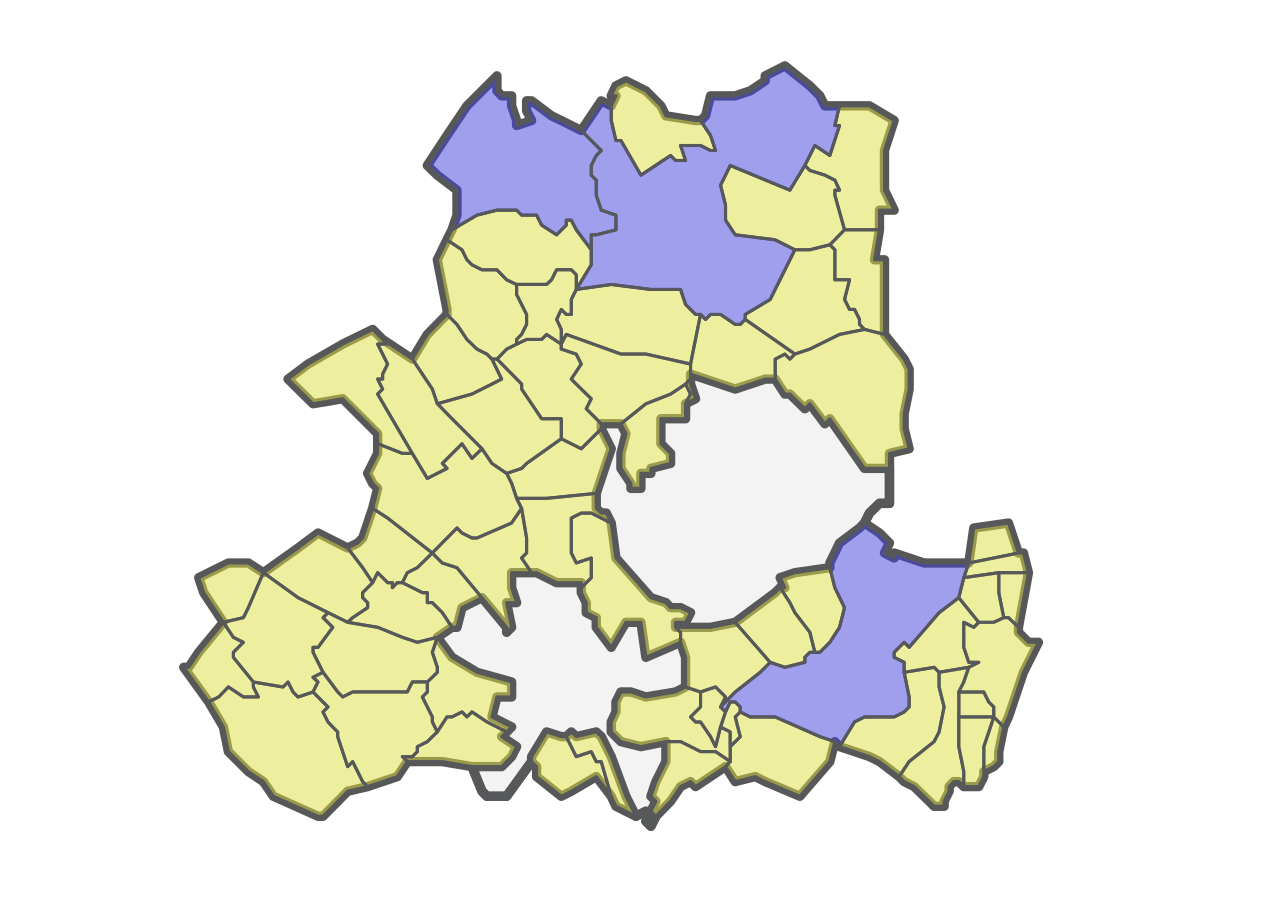
Magyar: Csongrád megye önkormányzati választókerületi térképe 1998-2006. A megyei önkormányzati választásokon 2006-ig használt választókerületi beosztás. Halvány kékkel a 10 ezer lakó fölötti középvárosok, míg halvány sárgával a legfeljebb 10 ezer lakóval bíró kistelepülések választókerületei láthatók. Az előbbibe három város tartozott, míg az utóbbiba 55 település. Csongrád megye két megyei jogú városának, Hódmezővásárhelynek és Szegednek a polgárai nem szavazhattak a megyei közgyűlés összetételéről, ezért nincsenek jelölve a térképen. |
| Date | |
| Source | Own work a KSH 2016-os közigazgatási térképe alapján |
| Author | Egyed |
| SVG development |
Licensing edit
I, the copyright holder of this work, hereby publish it under the following licenses:

|
Permission is granted to copy, distribute and/or modify this document under the terms of the GNU Free Documentation License, Version 1.2 or any later version published by the Free Software Foundation; with no Invariant Sections, no Front-Cover Texts, and no Back-Cover Texts. A copy of the license is included in the section entitled GNU Free Documentation License. |
This file is licensed under the Creative Commons Attribution-Share Alike 3.0 Unported license.
- You are free:
- to share – to copy, distribute and transmit the work
- to remix – to adapt the work
- Under the following conditions:
- attribution – You must give appropriate credit, provide a link to the license, and indicate if changes were made. You may do so in any reasonable manner, but not in any way that suggests the licensor endorses you or your use.
- share alike – If you remix, transform, or build upon the material, you must distribute your contributions under the same or compatible license as the original.
You may select the license of your choice.
File history
Click on a date/time to view the file as it appeared at that time.
| Date/Time | Thumbnail | Dimensions | User | Comment | |
|---|---|---|---|---|---|
| current | 19:57, 15 January 2017 | | 1,818 × 1,286 (45 KB) | Egyed (talk | contribs) | {{Információ | leírás = Csongrád megye önkormányzati választókerületi térképe 1998-2006. A megyei önkormányzati választásokon 2006-ig használt választókerületi beosztás. Halvány kékkel a 10 ezer lakó fölötti középvá… |
You cannot overwrite this file.
File usage on Commons
There are no pages that use this file.