File:Cwm Ty-du - geograph.org.uk - 305966.jpg
No higher resolution available.
Cwm_Ty-du_-_geograph.org.uk_-_305966.jpg (640 × 480 pixels, file size: 79 KB, MIME type: image/jpeg)
Captions
Captions
Add a one-line explanation of what this file represents
Summary edit
| Description |
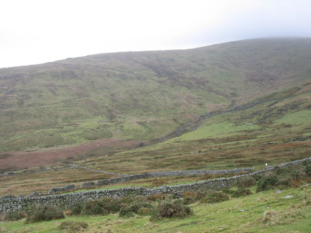
English: Cwm Ty-du Cwm Ty-du, on the north-eastern side of Moel Eilio, is drained by Afon Goch and its trubutaries. The farming landscape shows clearly the three-fold division of land into in-by, in-take and mountain land. This is a harsh environment in which to farm. Since WWII the number of farms on the eastern side of the Moel Eilio range has fallen from 5 in 1967 to 2 today due to amalgamations. |
| Date | |
| Source | From geograph.org.uk |
| Author | Eric Jones |
| Attribution (required by the license) | Eric Jones / Cwm Ty-du / |
| Camera location | | View this and other nearby images on: OpenStreetMap |
|---|
_heading:0.00&language=en)
| Object location | | View this and other nearby images on: OpenStreetMap |
|---|
_heading:0.00&language=en)
Licensing edit

|
This image was taken from the Geograph project collection. See this photograph's page on the Geograph website for the photographer's contact details. The copyright on this image is owned by Eric Jones and is licensed for reuse under the Creative Commons Attribution-ShareAlike 2.0 license.
|
This file is licensed under the Creative Commons Attribution-Share Alike 2.0 Generic license.
Attribution: Eric Jones
- You are free:
- to share – to copy, distribute and transmit the work
- to remix – to adapt the work
- Under the following conditions:
- attribution – You must give appropriate credit, provide a link to the license, and indicate if changes were made. You may do so in any reasonable manner, but not in any way that suggests the licensor endorses you or your use.
- share alike – If you remix, transform, or build upon the material, you must distribute your contributions under the same or compatible license as the original.
- Remove redundant categories and try to put this image in the most specific category/categories
- Remove this template
- The location categories are based on information from this geonames tool and this OpenStreetMap tool combined with a database. You can also have a look at this tool from mysociety.
- The topic category from Geograph was Farmland (find similar images at Geograph)
File history
Click on a date/time to view the file as it appeared at that time.
| Date/Time | Thumbnail | Dimensions | User | Comment | |
|---|---|---|---|---|---|
| current | 21:39, 22 December 2010 | | 640 × 480 (79 KB) | GeographBot (talk | contribs) | == {{int:filedesc}} == {{Information |description={{en|1=Cwm Ty-du Cwm Ty-du, on the north-eastern side of Moel Eilio, is drained by Afon Goch and its trubutaries. The farming landscape shows clearly the three-fold division of land into in-by, in-take and |
You cannot overwrite this file.
File usage on Commons
There are no pages that use this file.