File:Czerwony Bor 1 2.jpg
Size of this preview: 800 × 566 pixels. Other resolutions: 320 × 226 pixels | 640 × 453 pixels | 1,024 × 725 pixels | 1,280 × 906 pixels | 2,560 × 1,812 pixels | 3,306 × 2,340 pixels.
Original file (3,306 × 2,340 pixels, file size: 6.39 MB, MIME type: image/jpeg)
Captions
Captions
Add a one-line explanation of what this file represents
| Description |
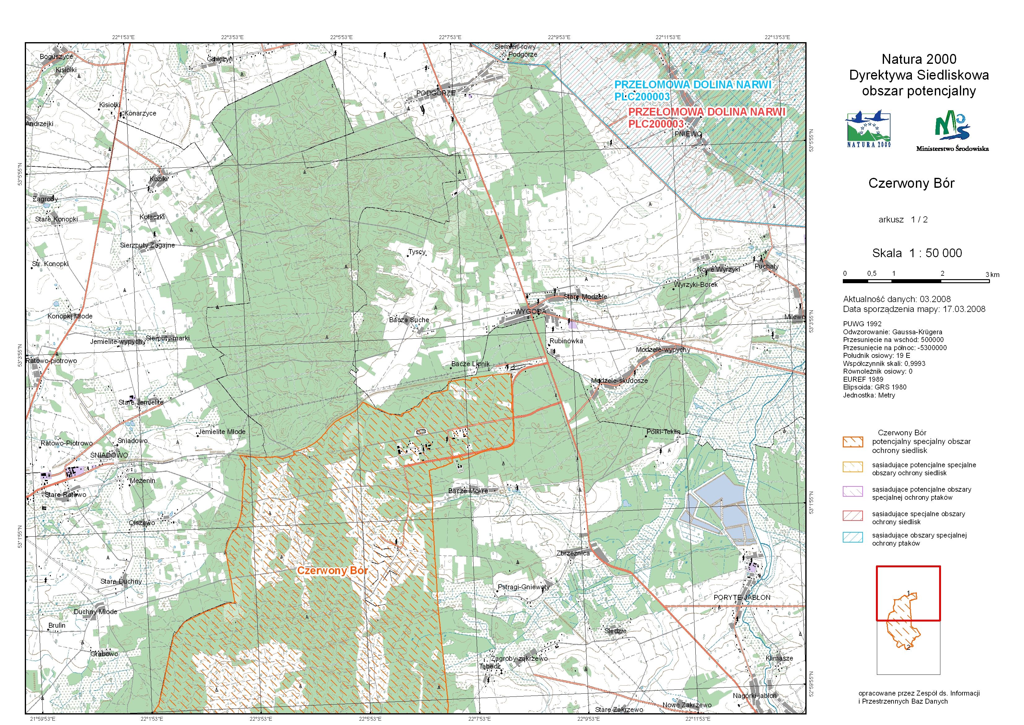
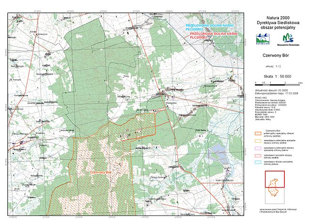
Polski: Mapa potencjalnego specjalnego obszaru ochrony siedlisk NATURA 2000 - Czerwony Bór, skala 1:50 000, arkusz 1/2 English: map of potential special protection area of NATURA 2000 - Czerwony Bór , scale 1:50 000, sheet 1/2 |
|||
| Date | ||||
| Source | http://natura2000.mos.gov.pl/natura2000/pl/dokumenty/n4/mapy/Czerwony_Bor_1_2.jpg | |||
| Author |
Polski: Ministerstwo Środowiska English: Polish Ministry of the Environment |
|||
| Permission (Reusing this file) |
|

File history
Click on a date/time to view the file as it appeared at that time.
| Date/Time | Thumbnail | Dimensions | User | Comment | |
|---|---|---|---|---|---|
| current | 09:37, 11 August 2008 | | 3,306 × 2,340 (6.39 MB) | Upior polnocy (talk | contribs) | {{Information |Description=Description={{pl|Mapa potencjalnego specjalnego obszaru ochrony siedlisk NATURA 2000 - ''Czerwony Bór'', skala 1:50 000, arkusz 1/2}}{{en|map of potential special protection area of [[:en:Natura 2000|NATURA |
You cannot overwrite this file.
File usage on Commons
The following page uses this file:
File usage on other wikis
The following other wikis use this file:
- Usage on lt.wikipedia.org
- Usage on pl.wikipedia.org