File:D-4-71-133-9 Gasthaus.jpg

Size of this preview: 661 × 599 pixels. Other resolutions: 265 × 240 pixels | 530 × 480 pixels | 847 × 768 pixels | 1,130 × 1,024 pixels | 2,259 × 2,048 pixels | 6,854 × 6,213 pixels.
Original file (6,854 × 6,213 pixels, file size: 5.69 MB, MIME type: image/jpeg)
Captions
Captions
Add a one-line explanation of what this file represents

|
NOTE: This image is a panorama consisting of multiple frames that were merged or stitched in Microsoft ICE. As a result, this image necessarily underwent some form of digital manipulation. These manipulations may include blending, blurring, cloning, and colour and perspective adjustments. As a result of these adjustments, the image content may be slightly different from reality at the points where multiple images were combined. This manipulation is often required due to lens, perspective, and parallax distortions.
|
Summary
edit
| Description |
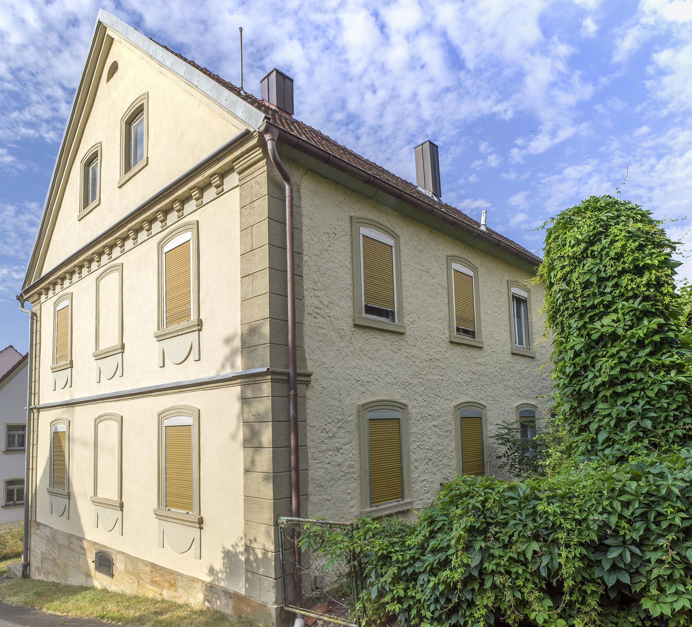
Deutsch: Ehemaliges Gasthaus zum Goldenen Hirschen, zweigeschossiger Satteldachbau, massiv und verputzt, mit Fensterschürzen, barockisierende Formen, Ende 19. Jahrhundert This is a photograph of an architectural monument. It is on the list of cultural monuments of Bayern, no. D-4-71-133-9. |
| Date | |
| Source | Own work |
| Author | Stephan van Helden |
| Camera location | | View this and other nearby images on: OpenStreetMap |
|---|
Das Bild wurde in folgendem Schutzgebiet aufgenommen:
|
Licensing
edit
I, the copyright holder of this work, hereby publish it under the following license:
This file is licensed under the Creative Commons Attribution-Share Alike 4.0 International license.
- You are free:
- to share – to copy, distribute and transmit the work
- to remix – to adapt the work
- Under the following conditions:
- attribution – You must give appropriate credit, provide a link to the license, and indicate if changes were made. You may do so in any reasonable manner, but not in any way that suggests the licensor endorses you or your use.
- share alike – If you remix, transform, or build upon the material, you must distribute your contributions under the same or compatible license as the original.

|
This image was uploaded as part of Wiki Loves Monuments 2022.
|
File history
Click on a date/time to view the file as it appeared at that time.
| Date/Time | Thumbnail | Dimensions | User | Comment | |
|---|---|---|---|---|---|
| current | 15:10, 3 September 2022 | | 6,854 × 6,213 (5.69 MB) | Plozessor (talk | contribs) | Uploaded own work with UploadWizard |
You cannot overwrite this file.
File usage on Commons
The following page uses this file:
File usage on other wikis
The following other wikis use this file:
- Usage on de.wikipedia.org
- Usage on www.wikidata.org