File:DETAILS OF BENTS FOR BRIDGE OVER C.N.and L. RY. NEWBERRY KINARDS ROAD - CSX Railroad Bridge (U.S. Route 76), U.S. Route 76 spanning CSX Railroad, Jalapa, Newberry County, SC HAER SC-34-19.tif

Size of this JPG preview of this TIF file: 741 × 600 pixels. Other resolutions: 297 × 240 pixels | 593 × 480 pixels | 949 × 768 pixels | 1,265 × 1,024 pixels | 2,531 × 2,048 pixels | 5,274 × 4,268 pixels.
Original file (5,274 × 4,268 pixels, file size: 21.47 MB, MIME type: image/tiff)
Captions
Captions
Add a one-line explanation of what this file represents
Summary edit
| DETAILS OF BENTS FOR BRIDGE OVER C.N.and L. RY. NEWBERRY KINARDS ROAD - CSX Railroad Bridge (U.S. Route 76), U.S. Route 76 spanning CSX Railroad, Jalapa, Newberry County, SC | ||||
|---|---|---|---|---|
| Title |
DETAILS OF BENTS FOR BRIDGE OVER C.N.and L. RY. NEWBERRY KINARDS ROAD - CSX Railroad Bridge (U.S. Route 76), U.S. Route 76 spanning CSX Railroad, Jalapa, Newberry County, SC |
|||
| Description |
South Carolina State Highway Department; Cherokee Construction Company; South Carolina Department of Transportation; Pennell, J Roy; Moorefield, Charles H; Anderson, N S; Barnwell, Joseph W, Jr; Harwell, A; McGowan, Samuel; Sawyer, Ben M; Gooding, W J; C. N. and L. Railroad; CSX Railroad; New South Associates, contractor; Calloway, Deborah, transmitter |
|||
| Depicted place | South Carolina; Newberry County; Jalapa | |||
| Date | Documentation compiled after 1968 | |||
| Dimensions | 8 x 10 in. | |||
| Current location |
Library of Congress Prints and Photographs Division Washington, D.C. 20540 USA http://hdl.loc.gov/loc.pnp/pp.print |
|||
| Accession number |
HAER SC-34-19 |
|||
| Credit line |
|
|||
| Notes |
|
|||
| Source | https://www.loc.gov/pictures/item/sc1108.photos.203239p | |||
| Permission (Reusing this file) |
|
|||

| Object location | | View this and other nearby images on: OpenStreetMap |
|---|
File history
Click on a date/time to view the file as it appeared at that time.
| Date/Time | Thumbnail | Dimensions | User | Comment | |
|---|---|---|---|---|---|
| current | 21:06, 1 August 2014 | 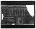 | 5,274 × 4,268 (21.47 MB) | Fæ (talk | contribs) | GWToolset: Creating mediafile for Fæ. HABS 2014-08-01 (3201:3400) |
You cannot overwrite this file.
File usage on Commons
The following page uses this file: