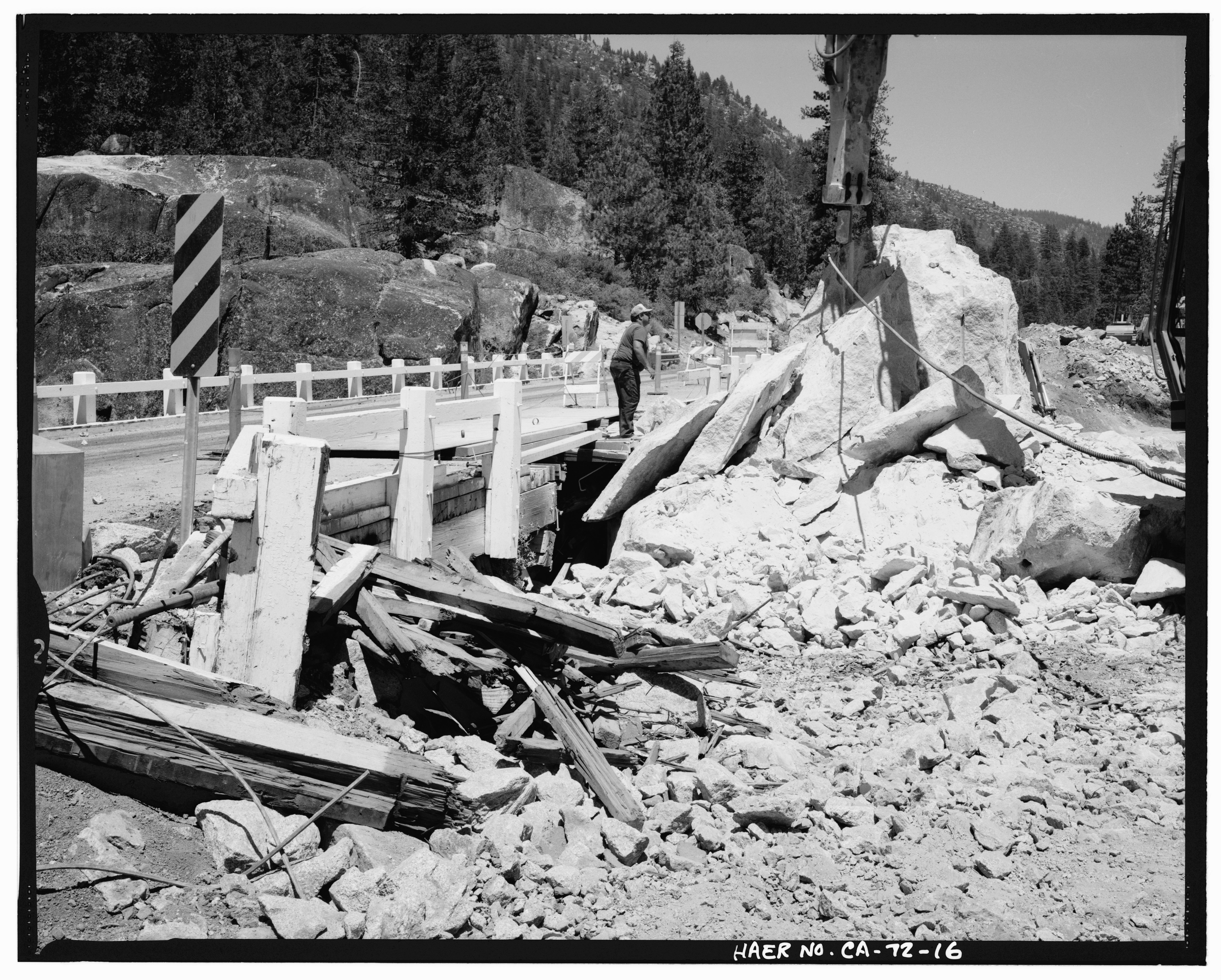
File:DETAIL VIEW OF DAMAGED AREA OF WEST APPROACH SPAN, SHOWING REMAINING GRANITE OUTCROP BEING BROKEN UP BY HYDRAULIC HAMMER MOUNTED ON A BACKHOE, LOOKING EAST-NORTHEAST - Middle HAER CAL,55-DARD.V,1-16.tif

Size of this JPG preview of this TIF file: 747 × 600 pixels. Other resolutions: 299 × 240 pixels | 598 × 480 pixels | 957 × 768 pixels | 1,275 × 1,024 pixels | 2,551 × 2,048 pixels | 5,085 × 4,083 pixels.
Original file (5,085 × 4,083 pixels, file size: 19.8 MB, MIME type: image/tiff)
Captions
Captions
Add a one-line explanation of what this file represents
Summary edit
| Photographer |
Tateishi, Don Related names:
|
|||
| Title |
DETAIL VIEW OF DAMAGED AREA OF WEST APPROACH SPAN, SHOWING REMAINING GRANITE OUTCROP BEING BROKEN UP BY HYDRAULIC HAMMER MOUNTED ON A BACKHOE, LOOKING EAST-NORTHEAST - Middle Fork Stanislaus River Bridge, Spans Middle Fork Stanislaus River at State Highway 108, Dardanelle, Tuolumne County, CA |
|||
| Depicted place | California; Tuolumne County; Dardanelle | |||
| Date | 1989 | |||
| Dimensions | 4 x 5 in. | |||
| Current location |
Library of Congress Prints and Photographs Division Washington, D.C. 20540 USA http://hdl.loc.gov/loc.pnp/pp.print |
|||
| Accession number |
HAER CAL,55-DARD.V,1-16 |
|||
| Credit line |
|
|||
| Notes |
|
|||
| Source | https://www.loc.gov/pictures/item/ca1532.photos.020160p | |||
| Permission (Reusing this file) |
|

| Object location | | View this and other nearby images on: OpenStreetMap |
|---|
File history
Click on a date/time to view the file as it appeared at that time.
| Date/Time | Thumbnail | Dimensions | User | Comment | |
|---|---|---|---|---|---|
| current | 17:05, 3 July 2014 |  | 5,085 × 4,083 (19.8 MB) | Fæ (talk | contribs) | GWToolset: Creating mediafile for Fæ. HABS batch upload 2 July 2014 (301:400) |
You cannot overwrite this file.
File usage on Commons
The following page uses this file: