File:DG Gemeindegliederung.png
Size of this preview: 392 × 599 pixels. Other resolutions: 157 × 240 pixels | 314 × 480 pixels | 883 × 1,349 pixels.
Original file (883 × 1,349 pixels, file size: 52 KB, MIME type: image/png)
Captions
Captions
Add a one-line explanation of what this file represents
Summary edit
| Description |
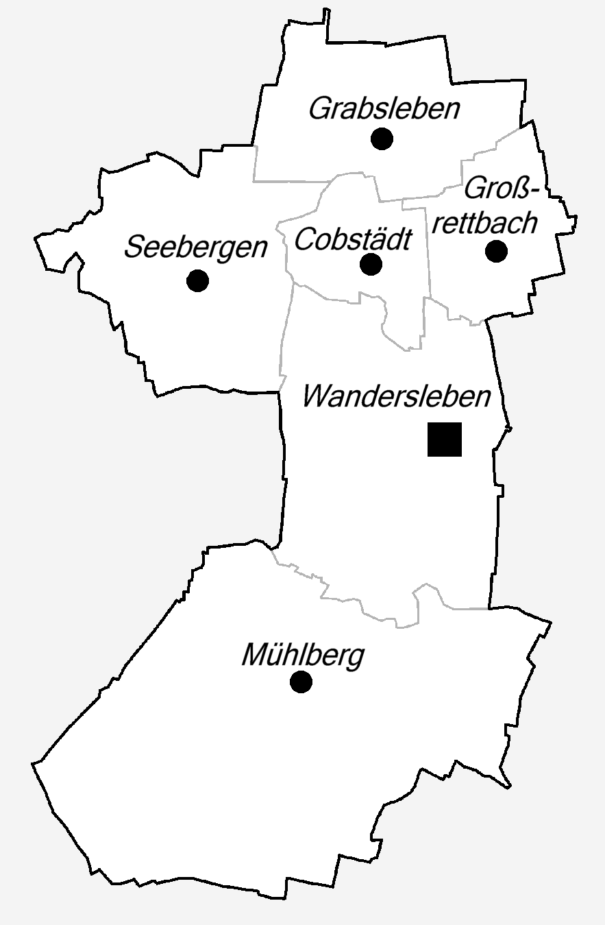
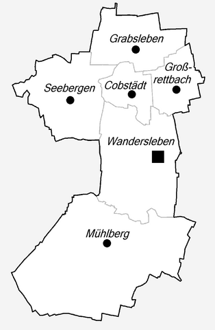
English: District-Maps of Drei Gleichen village in Thuringia. |
| Date | |
| Source | Own work |
| Author | Metilsteiner |
Licensing edit
I, the copyright holder of this work, hereby publish it under the following license:
This file is licensed under the Creative Commons Attribution 3.0 Unported license.
- You are free:
- to share – to copy, distribute and transmit the work
- to remix – to adapt the work
- Under the following conditions:
- attribution – You must give appropriate credit, provide a link to the license, and indicate if changes were made. You may do so in any reasonable manner, but not in any way that suggests the licensor endorses you or your use.
File history
Click on a date/time to view the file as it appeared at that time.
| Date/Time | Thumbnail | Dimensions | User | Comment | |
|---|---|---|---|---|---|
| current | 19:01, 28 June 2010 | | 883 × 1,349 (52 KB) | Metilsteiner (talk | contribs) | {{Information |Description={{en|1=District-Maps of Drei Gleichen village in Thuringia.}} |Source={{own}} |Author=Metilsteiner |Date=2010-06-28 |Permission= |other_versions= }} Category:District-Maps of Drei Gleichen |
You cannot overwrite this file.
File usage on Commons
The following page uses this file:
File usage on other wikis
The following other wikis use this file:
- Usage on ceb.wikipedia.org
- Usage on de.wikipedia.org
- Usage on de.wikivoyage.org
- Usage on es.wikipedia.org
- Usage on eu.wikipedia.org
- Usage on fr.wikipedia.org
- Usage on hu.wikipedia.org
- Usage on ro.wikipedia.org
- Usage on sv.wikipedia.org
- Usage on www.wikidata.org
- Usage on zh.wikipedia.org