File:DZA orthographic.svg

Size of this PNG preview of this SVG file: 550 × 550 pixels. Other resolutions: 240 × 240 pixels | 480 × 480 pixels | 768 × 768 pixels | 1,024 × 1,024 pixels | 2,048 × 2,048 pixels.
Original file (SVG file, nominally 550 × 550 pixels, file size: 1.35 MB)
Captions
Captions
Add a one-line explanation of what this file represents
Summary edit
| Description |
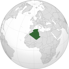
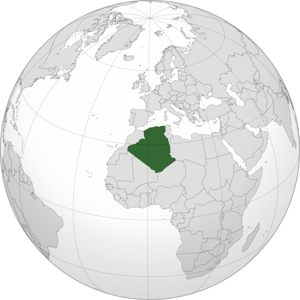
English: Orthographic map of Algeria centered at 28° N, 1° E.
Official territory.
Claimed territories. |
| Date | |
| Source |
Own work with Natural Earth Data This W3C-unspecified vector image was created with Inkscape . |
| Author | Addicted04 |
Licensing edit
I, the copyright holder of this work, hereby publish it under the following license:
This file is licensed under the Creative Commons Attribution-Share Alike 3.0 Unported license.
- You are free:
- to share – to copy, distribute and transmit the work
- to remix – to adapt the work
- Under the following conditions:
- attribution – You must give appropriate credit, provide a link to the license, and indicate if changes were made. You may do so in any reasonable manner, but not in any way that suggests the licensor endorses you or your use.
- share alike – If you remix, transform, or build upon the material, you must distribute your contributions under the same or compatible license as the original.
File history
Click on a date/time to view the file as it appeared at that time.
| Date/Time | Thumbnail | Dimensions | User | Comment | |
|---|---|---|---|---|---|
| current | 21:20, 31 December 2020 | | 550 × 550 (1.35 MB) | Flaspec (talk | contribs) | Internationally recognized territory of Somalia. |
| 13:03, 6 February 2020 |  | 550 × 550 (1.35 MB) | Rob984 (talk | contribs) | dashed Western Sahara, Golan Heights, and Kosovo | |
| 21:18, 8 July 2012 |  | 550 × 550 (1.35 MB) | Addicted04 (talk | contribs) |
You cannot overwrite this file.
File usage on Commons
The following page uses this file:
File usage on other wikis
The following other wikis use this file:
- Usage on ar.wikipedia.org
- مستخدم:جار الله/قائمة صور مقالات العلاقات الثنائية
- العلاقات الأنغولية الجزائرية
- العلاقات الجزائرية الكورية الجنوبية
- العلاقات الجزائرية الإريترية
- العلاقات الجزائرية السويسرية
- العلاقات الألمانية الجزائرية
- العلاقات الجزائرية الليختنشتانية
- العلاقات الجزائرية البوليفية
- العلاقات الجزائرية الموزمبيقية
- العلاقات الألبانية الجزائرية
- العلاقات الجزائرية البلجيكية
- العلاقات الجزائرية الإثيوبية
- العلاقات الجزائرية البيلاروسية
- العلاقات الجزائرية الطاجيكستانية
- العلاقات الجزائرية الرومانية
- العلاقات الأرجنتينية الجزائرية
- العلاقات الجزائرية الغامبية
- العلاقات الجزائرية السيراليونية
- العلاقات الجزائرية النيبالية
- العلاقات الجزائرية الليبيرية
- العلاقات التشيكية الجزائرية
- العلاقات الجزائرية الميانمارية
- العلاقات الجزائرية الزيمبابوية
- العلاقات الجزائرية النيجيرية
- العلاقات الجزائرية اليمنية
- العلاقات الجزائرية الفانواتية
- العلاقات الجزائرية الغابونية
- العلاقات الجزائرية البنمية
- العلاقات الجزائرية الكوبية
- العلاقات الجزائرية الجورجية
- العلاقات الجزائرية الكورية الشمالية
- العلاقات الجزائرية الإيطالية
- العلاقات الجزائرية الناوروية
- العلاقات الأسترالية الجزائرية
- العلاقات الجزائرية الزامبية
- العلاقات الجزائرية الفيجية
- العلاقات الجزائرية المارشالية
- العلاقات الأذربيجانية الجزائرية
- العلاقات الجزائرية الكويتية
- العلاقات الجزائرية الكونغوية
- العلاقات الجزائرية الدومينيكانية
- العلاقات البرازيلية الجزائرية
- العلاقات الجزائرية الغرينادية
- العلاقات الجزائرية الكازاخستانية
- العلاقات الجزائرية الكوستاريكية
- العلاقات الجزائرية الباهاماسية
- العلاقات الجزائرية الصربية
- العلاقات الأرمينية الجزائرية
- العلاقات الجزائرية الهندوراسية
- العلاقات الجزائرية الإسواتينية
View more global usage of this file.