File:Daaquam ME border station - panoramio.jpg
No higher resolution available.
Daaquam_ME_border_station_-_panoramio.jpg (754 × 545 pixels, file size: 36 KB, MIME type: image/jpeg)
Captions
Captions
Add a one-line explanation of what this file represents
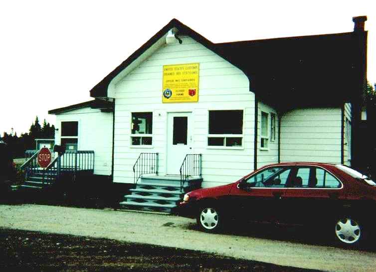
| Description | Daaquam ME border station, as seen in 1999. This border crossing was closed in 2004. | ||
| Date | 10 January 2009 (original upload date) | ||
| Source | https://web.archive.org/web/20161012071658/http://www.panoramio.com/photo/17707040 | ||
| Author | wbaron | ||
| Permission (Reusing this file) |
This file is licensed under the Creative Commons Attribution-Share Alike 3.0 Unported license. Attribution: wbaron
|
| Camera location | | View this and other nearby images on: OpenStreetMap |
|---|
File history
Click on a date/time to view the file as it appeared at that time.
| Date/Time | Thumbnail | Dimensions | User | Comment | |
|---|---|---|---|---|---|
| current | 07:19, 4 October 2016 | | 754 × 545 (36 KB) | Panoramio upload bot (talk | contribs) | {{Information |description=Daaquam ME border station |date={{Original upload date|2009-01-10}} |source=http://www.panoramio.com/photo/17707040 |author=[http://www.panoramio.com/user/308797?with_photo_id=17707040 wbaron] |permission={{cc-by-sa-3.0|wbaro... |
You cannot overwrite this file.
File usage on Commons
There are no pages that use this file.
File usage on other wikis
The following other wikis use this file:
- Usage on en.wikipedia.org