File:Dam No. 8 and Guard lock 8, looking at Potomac and Wills Creek at End of C and O Canal.jpg

Size of this preview: 800 × 533 pixels. Other resolutions: 320 × 213 pixels | 640 × 427 pixels | 1,024 × 683 pixels | 1,280 × 853 pixels | 2,560 × 1,707 pixels | 4,896 × 3,264 pixels.
Original file (4,896 × 3,264 pixels, file size: 10.65 MB, MIME type: image/jpeg)
Captions
Captions
Add a one-line explanation of what this file represents
Summary
edit
| Description |
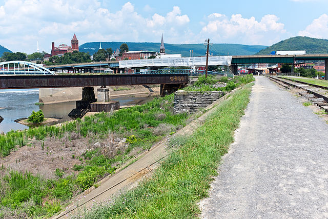
English: End of Canal in Cumberland, MD, looking to where the Canal joins the Potomac River and Wills Creek. Stone abutment in middle of photo is where the end of Dam No. 8 was. Potomac river continues to the left, Wills Creek in the center. Guard lock No. 8 is underneath railroad (just before the tracks join, and not really visible in this photo since it is underneath all of that). Western Maryland train station just visible in background. |
| Date | |
| Source | Own work |
| Author | Bonnachoven |
| Camera location | | View this and other nearby images on: OpenStreetMap |
|---|
Licensing
edit
I, the copyright holder of this work, hereby publish it under the following license:
| This file is made available under the Creative Commons CC0 1.0 Universal Public Domain Dedication. | |
| The person who associated a work with this deed has dedicated the work to the public domain by waiving all of their rights to the work worldwide under copyright law, including all related and neighboring rights, to the extent allowed by law. You can copy, modify, distribute and perform the work, even for commercial purposes, all without asking permission.
|
File history
Click on a date/time to view the file as it appeared at that time.
| Date/Time | Thumbnail | Dimensions | User | Comment | |
|---|---|---|---|---|---|
| current | 01:02, 8 January 2014 | | 4,896 × 3,264 (10.65 MB) | Bonnachoven (talk | contribs) | {{Information |Description ={{en|1=End of Canal in Cumberland, MD, looking to where the Canal joins the Potomac River and Wills Creek. Stone abutment in middle of photo is where the end of Dam No. 8 was. Potomac river continues to the left, Wills Cr... |
You cannot overwrite this file.
File usage on Commons
There are no pages that use this file.