File:Dar-Gora on the Map of Tsaritsyn 1909.png
Size of this preview: 800 × 367 pixels. Other resolutions: 320 × 147 pixels | 640 × 293 pixels | 1,024 × 470 pixels | 2,000 × 917 pixels.
Original file (2,000 × 917 pixels, file size: 2.34 MB, MIME type: image/png)
Captions
Captions
Add a one-line explanation of what this file represents
Summary
edit
| Description |
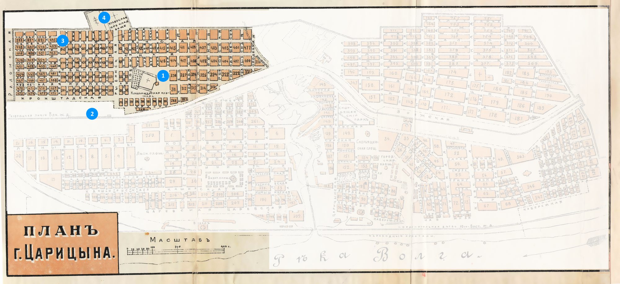
Русский: Исторический район Дар-гора (до 1910 года — Вор-гора) на плане города Царицына (с 1961 года — Волгоград) 1909 года. Границы района приведены по оценкам волгоградского краеведа Романа Шкоды с сайта Царицын.рф. Цифрами обозначены значимые постройки и объекты: 1 — Казанский собор; 2 — Тихорецкий вокзал (ныне — Волгоград II); 3 — Благовещенская церковь, не сохранилась; 4 — старое Царицынское кладбище. |
| Date | |
| Source |
This file was derived from: Map Tsaritsyn 1909.jpg |
| Author |
|
Licensing
edit
This file is licensed under the Creative Commons Attribution-Share Alike 4.0 International license.
- You are free:
- to share – to copy, distribute and transmit the work
- to remix – to adapt the work
- Under the following conditions:
- attribution – You must give appropriate credit, provide a link to the license, and indicate if changes were made. You may do so in any reasonable manner, but not in any way that suggests the licensor endorses you or your use.
- share alike – If you remix, transform, or build upon the material, you must distribute your contributions under the same or compatible license as the original.
File history
Click on a date/time to view the file as it appeared at that time.
| Date/Time | Thumbnail | Dimensions | User | Comment | |
|---|---|---|---|---|---|
| current | 03:34, 23 November 2021 | | 2,000 × 917 (2.34 MB) | Redboston (talk | contribs) | Uploaded a work by * original: {{author|unknown}} * derivated: {{u|Redboston}} from {{Derived from |1=Map Tsaritsyn 1909.jpg }} with UploadWizard |
You cannot overwrite this file.
File usage on Commons
The following page uses this file:
File usage on other wikis
The following other wikis use this file:
- Usage on ru.wikipedia.org
- Usage on www.wikidata.org