File:Database historical maps Western Tigray graphical abstract.pdf

Size of this JPG preview of this PDF file: 800 × 566 pixels. Other resolutions: 320 × 226 pixels | 640 × 453 pixels | 1,024 × 724 pixels | 1,280 × 905 pixels | 1,752 × 1,239 pixels.
Original file (1,752 × 1,239 pixels, file size: 368 KB, MIME type: application/pdf)
Captions
Captions
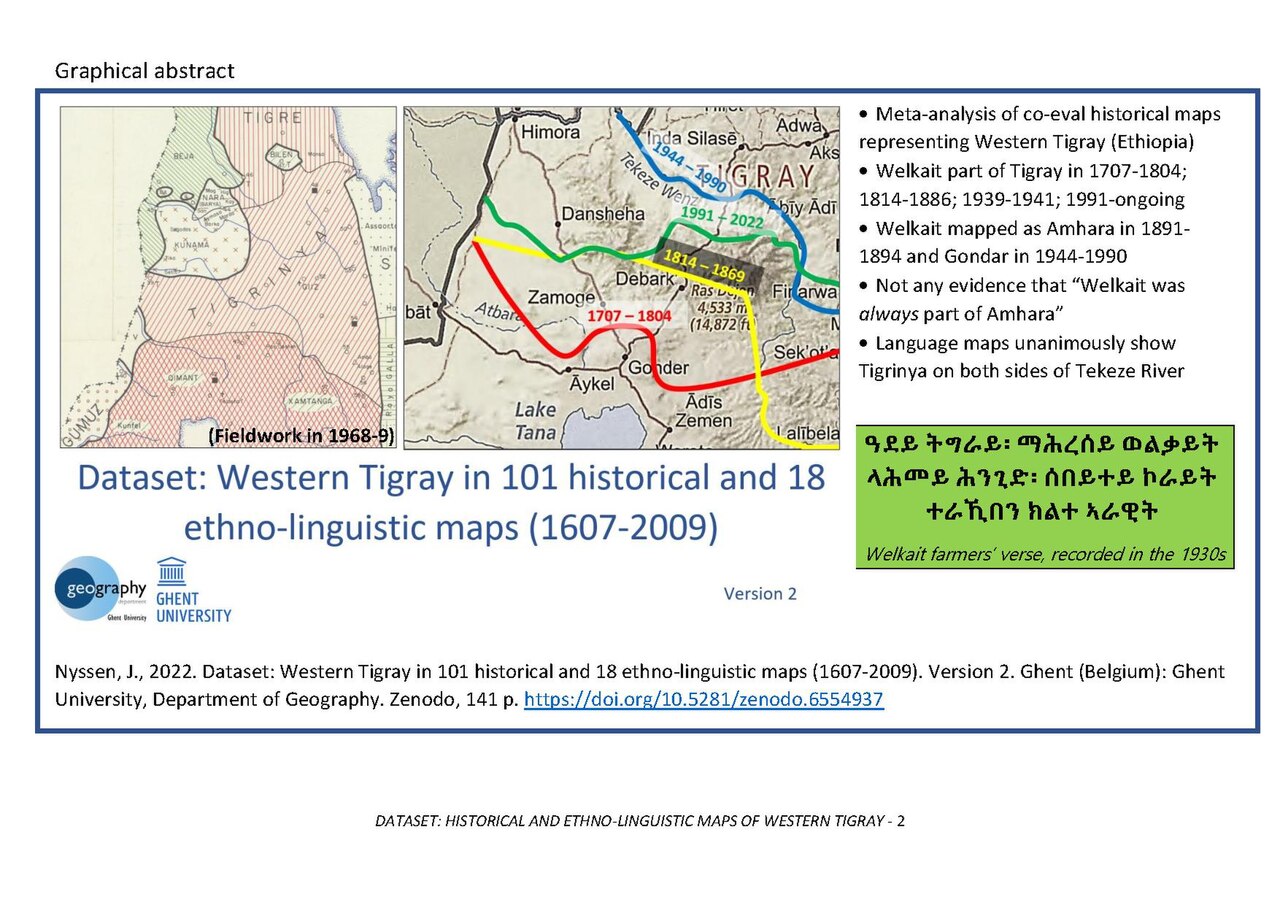
Dataset Western Tigray maps - graphical abstract
Summary edit
| Description |
English: Dataset Western Tigray maps - graphical abstract |
| Date | |
| Source |
Dataset: Western Tigray in 101 historical and 18 ethno-linguistic maps (1607-2009). https://zenodo.org/record/6576524 |
| Author | Jan Nyssen |
| Camera location | | View this and other nearby images on: OpenStreetMap |
|---|
Licensing edit
This file is licensed under the Creative Commons Attribution-Share Alike 4.0 International license.
- You are free:
- to share – to copy, distribute and transmit the work
- to remix – to adapt the work
- Under the following conditions:
- attribution – You must give appropriate credit, provide a link to the license, and indicate if changes were made. You may do so in any reasonable manner, but not in any way that suggests the licensor endorses you or your use.
- share alike – If you remix, transform, or build upon the material, you must distribute your contributions under the same or compatible license as the original.
File history
Click on a date/time to view the file as it appeared at that time.
| Date/Time | Thumbnail | Dimensions | User | Comment | |
|---|---|---|---|---|---|
| current | 05:27, 6 June 2022 |  | 1,752 × 1,239 (368 KB) | Jnyssen (talk | contribs) | Uploaded a work by Jan Nyssen from Dataset: Western Tigray in 101 historical and 18 ethno-linguistic maps (1607-2009). https://zenodo.org/record/6576524 with UploadWizard |
You cannot overwrite this file.
File usage on Commons
There are no pages that use this file.