File:Daugava western dvina map.jpg
Size of this preview: 649 × 599 pixels. Other resolutions: 260 × 240 pixels | 520 × 480 pixels | 832 × 768 pixels | 1,276 × 1,178 pixels.
Original file (1,276 × 1,178 pixels, file size: 254 KB, MIME type: image/jpeg)
Captions
Captions
Add a one-line explanation of what this file represents

|
This map image could be re-created using vector graphics as an SVG file. This has several advantages; see Commons:Media for cleanup for more information. If an SVG form of this image is available, please upload it and afterwards replace this template with
{{vector version available|new image name}}.
It is recommended to name the SVG file “Daugava western dvina map.svg”—then the template Vector version available (or Vva) does not need the new image name parameter. |

Summary edit
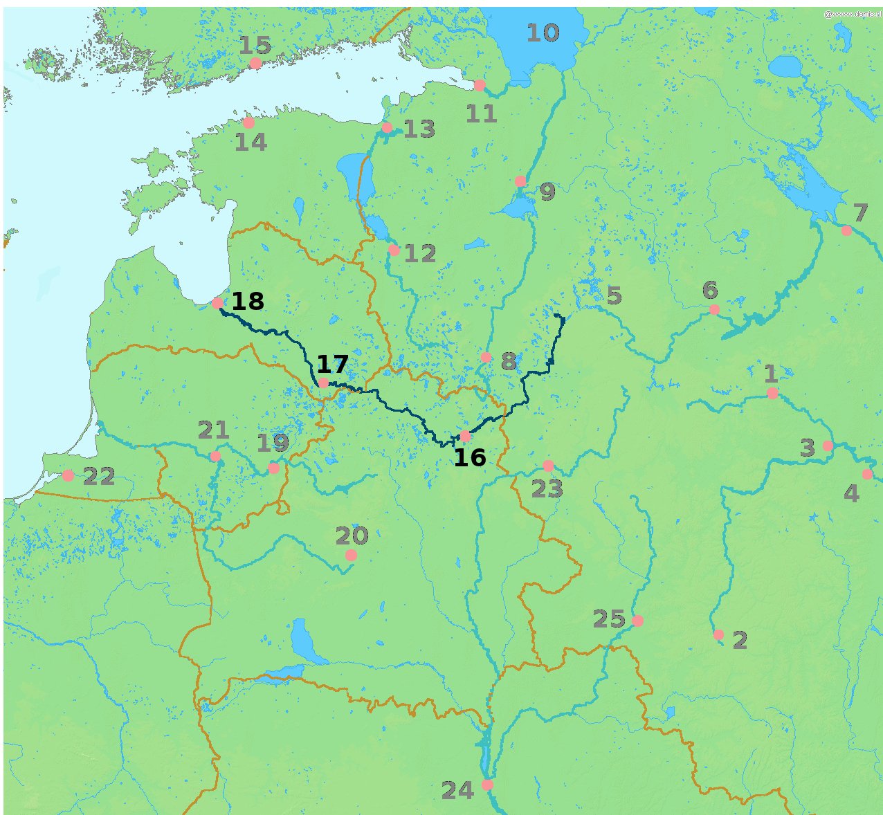
| Description | Map highlighting the river Daugava/Western Dvina (Daugava, Западная Двина́ (Zapadnaya Dvina), traditionally Дзвiна or newly Заходняя Дзвіна) flowing through Vitebsk (16), Daugavpils (17) and Riga (18). |
| Date | 13 March 2010, 17:59 (UTC) |
| Source | |
| Author |
|
| This is a retouched picture, which means that it has been digitally altered from its original version. Modifications: Highlighted the Daugava river and cities it passes through. The original can be viewed here: LA2-Rivers of western Russia.png:
|
This image is in the public domain because it came from the site https://www.demis.nl/products/web-map-server/examples/ and was released by the copyright holder. Permission is granted to copy, distribute and/or modify this map since it is based on free of copyright images from: www.demis.nl. See also approval email on de.wp and its clarification.
|
| This work has been released into the public domain by its copyright holder, www.demis.nl. This applies worldwide. In some countries this may not be legally possible; if so: www.demis.nl grants anyone the right to use this work for any purpose, without any conditions, unless such conditions are required by law.
|
Original upload log edit
This image is a derivative work of the following images:
- File:LA2-Rivers_of_western_Russia.png licensed with PD-Demis
- 2008-05-20T22:30:46Z LA2 1274x1178 (269354 Bytes) {{Information |Description=Map of western Russia, with national borders marked (brown), rivers emphasized (dark blue) and major cities (pink) numbered (black). Bounding box West 19°, South 50°, East 40°, North 61°. Center
Uploaded with derivativeFX
File history
Click on a date/time to view the file as it appeared at that time.
| Date/Time | Thumbnail | Dimensions | User | Comment | |
|---|---|---|---|---|---|
| current | 17:59, 13 March 2010 | | 1,276 × 1,178 (254 KB) | Alþykkr (talk | contribs) | {{Information |Description=Map highlighting the river Daugava/Western Dvina ({{lang-lv|Daugava}}, {{lang-ru|Западная Двина́ (Zapadnaya Dvina)}}, {{lang-be|traditionally Дзвiна or newly Заходняя Дзвіна}}, {{IPA2|zaˈxodnʲa |
You cannot overwrite this file.
File usage on Commons
There are no pages that use this file.
File usage on other wikis
The following other wikis use this file:
- Usage on be-tarask.wikipedia.org
- Usage on be.wikipedia.org
- Usage on da.wikipedia.org
- Usage on de.wikipedia.org
- Usage on eu.wikipedia.org
- Usage on fr.wikipedia.org
- Usage on pl.wikipedia.org