File:Dead-Sea---Salt-Evaporation-Ponds.jpg
Size of this preview: 525 × 599 pixels. Other resolutions: 210 × 240 pixels | 421 × 480 pixels | 673 × 768 pixels | 1,057 × 1,206 pixels.
Original file (1,057 × 1,206 pixels, file size: 518 KB, MIME type: image/jpeg)
Captions
Captions
Add a one-line explanation of what this file represents
Summary edit
| Description |
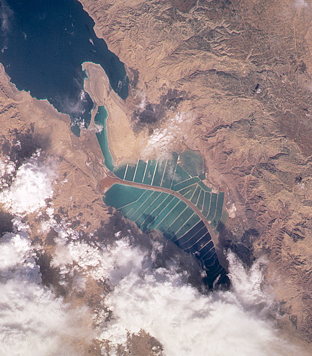
English: Orbital image of Jordanian and Israeli mineral evaporation ponds at the south end of the Dead Sea, separated by a central dike that runs roughly north-south along the international border. |
| Source | http://visibleearth.nasa.gov/cgi-bin/viewrecord?7875 |
| Author | Image taken from the space shuttle by the STS102 crew in March 2001. |
Captioned As edit
| Page | Caption |
|---|---|
| Dead Sea | View of the mineral evaporation ponds almost 12 years later (STS-102). A northern and small southeastern extension were added and the large polygonal ponds subdivided. |
Licensing edit
| This file is in the public domain in the United States because it was solely created by NASA. NASA copyright policy states that "NASA material is not protected by copyright unless noted". (See Template:PD-USGov, NASA copyright policy page or JPL Image Use Policy.) | ||
 |
Warnings:
|
Original upload log edit
The original description page was here. All following user names refer to en.wikipedia.
| Date/Time | Dimensions | User | Comment |
|---|---|---|---|
| 2004-10-10 19:45 | 1057×1206× (530534 bytes) | Solipsist | Satelite image of [[Jordan]]ian salt evaporation ponds at the south end of the [[Dead Sea]] |
File history
Click on a date/time to view the file as it appeared at that time.
| Date/Time | Thumbnail | Dimensions | User | Comment | |
|---|---|---|---|---|---|
| current | 04:47, 22 February 2017 | | 1,057 × 1,206 (518 KB) | Ineuw (talk | contribs) | Transferred from en.wikipedia |
You cannot overwrite this file.
File usage on Commons
The following page uses this file:
File usage on other wikis
The following other wikis use this file:
- Usage on en.wikipedia.org
- Usage on he.wikipedia.org
- Usage on id.wikipedia.org
- Usage on ru.wikipedia.org
- Usage on sl.wikipedia.org
- Usage on tr.wikipedia.org
- Usage on vi.wikipedia.org