File:Deforestation, Madagascar photographed during STS-31.jpg

Size of this preview: 476 × 599 pixels. Other resolutions: 191 × 240 pixels | 381 × 480 pixels | 610 × 768 pixels | 813 × 1,024 pixels | 1,627 × 2,048 pixels | 3,264 × 4,109 pixels.
Original file (3,264 × 4,109 pixels, file size: 2.05 MB, MIME type: image/jpeg)
Captions
Captions
Deforestation, Madagascar photographed during STS-31
Summary
edit
| Description |
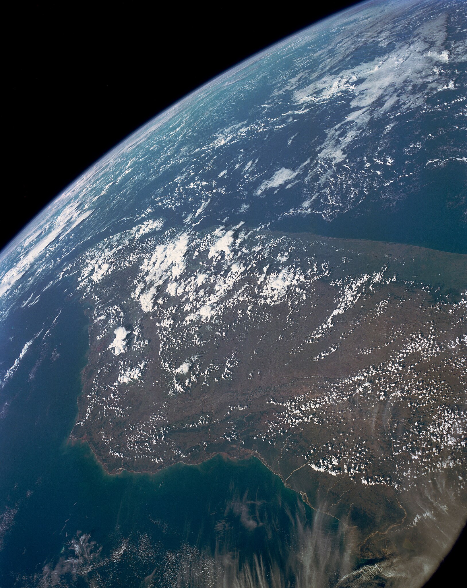
English: STS031-152-000hs - This high oblique view shows the majority of the island of Madagascar (19.0S, 47.5E). This Texas sized island is now largely deforested and is suffering from severe soil erosion as well as a declining biological species diversity and productivity. At the turn of the century, the island was almost totally forested but now, forests cover only about 10 percent of the surface. Evidence of soil erosion can be seen in the offshore sediment plumes. |
| Date | |
| Source | NASA Image and Video Library JSC Gateway to Astronaut Photography of Earth |
| Author | NASA |
| Camera location | | View this and other nearby images on: OpenStreetMap |
|---|
This image or video was catalogued by Johnson Space Center of the United States National Aeronautics and Space Administration (NASA) under Photo ID: s31-152-000hs and Alternate ID: STS031-152-000hs. This tag does not indicate the copyright status of the attached work. A normal copyright tag is still required. See Commons:Licensing. Other languages:
|
Licensing
edit
| This file is in the public domain in the United States because it was solely created by NASA. NASA copyright policy states that "NASA material is not protected by copyright unless noted". (See Template:PD-USGov, NASA copyright policy page or JPL Image Use Policy.) | ||
 |
Warnings:
|
File history
Click on a date/time to view the file as it appeared at that time.
| Date/Time | Thumbnail | Dimensions | User | Comment | |
|---|---|---|---|---|---|
| current | 20:29, 12 January 2021 | | 3,264 × 4,109 (2.05 MB) | Askeuhd (talk | contribs) | Uploaded a work by NASA from [https://images.nasa.gov/ NASA Image and Video Library] with UploadWizard |
You cannot overwrite this file.
File usage on Commons
There are no pages that use this file.